Get ready for more sunshine central New York
SYRACUSE, NY (WSYR-TV) – If you like what you felt and saw Wednesday, you’ll love the rest of the week! Details are below…
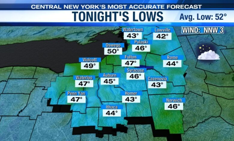
Tranquil, but quite cool tonight
Tonight is quite cool under a clear to partly cloudy sky with lows dropping into the 40s for most. For Syracuse, that would make it the coolest morning since May 13th.
That said, be sure to close the windows before going to bed tonight otherwise you may very well wake up shivering and needing to shut them overnight.
Staying cool, but gorgeous the rest of the week!
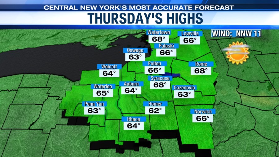
After reaching up to around 70° in Syracuse on Wednesday, it’s even a touch cooler on Thursday with more sunshine across all of CNY!
Highs cool back into the mid to upper 60s Thursday as high pressure settles in from the northwest. Yes, a bit of a fall feel to the air is expected by day and night.
How will it look and feel for your outdoor activities Thursday, including the Kenny Chesney and Megan Moroney amp show? Click here to find out.
Warming trend begins Friday
The 70s return Friday, and no we aren’t talking about the disco era. Central New York will be sun splashed once again as high pressure remains in control to round out the week.
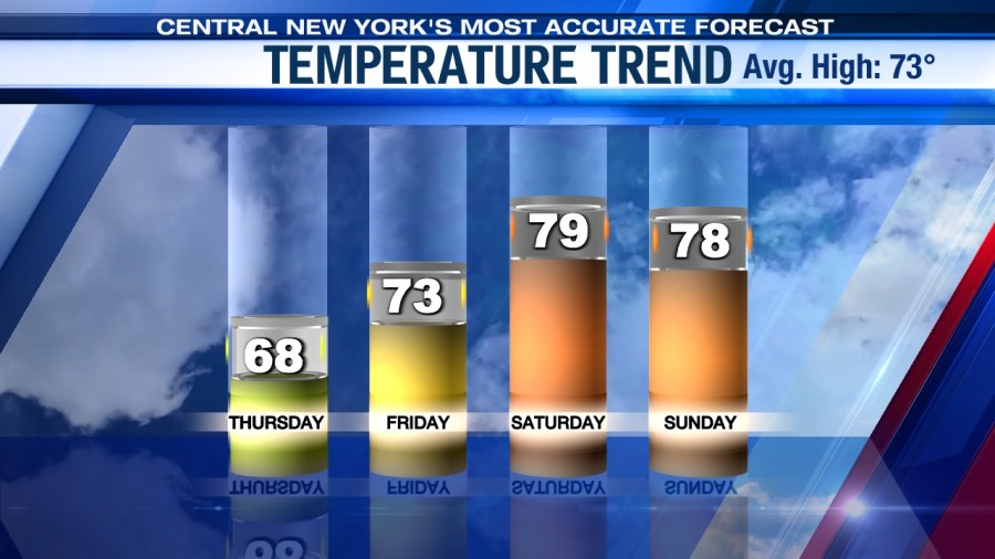
Feeling summery this weekend but is it dry?
The start of the weekend and June looks great under more sun and a warmer high in the upper 70s to near 80!
We may be a touch cooler, or about the same as Saturday temperatures for Sunday thanks to more clouds and possibly a few spotty showers compliments of a weakening wave of low pressure approaching.
Temperatures remain well into the 70s to possibly 80 if we see enough sun. It’s slightly muggier Sunday too.
There are still strong signs that we could heat up even more so early to mid-next week! Stay tuned.
Check out the latest 7-day forecast.