Enjoy the warmer Sunday? If so, you’ll love what’s ahead
SYRACUSE, NY (WSYR-TV) – It was a nicer and warmer Sunday, and it gets even warmer the next few days. How warm does it get? Find out below…
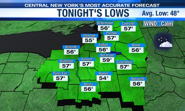
Tranquil & mild overnight
It’s a quiet and mild overnight under a clear to partly cloudy sky. Lows drop into the 50s to near 60 with a bit of patchy valley fog too.
A stretch of summery weather this week
It’ll become very warm to hot over the next few days with a good deal of sun and the help of a developing southwesterly wind (typically a warm wind for Syracuse). This should help push temperatures into the mid to upper 80s through Tuesday, and if we stay mainly dry with enough sun Wednesday, we could very well warm into the low 90s! The record high Wednesday is 92° set back in 1911. We shall see…
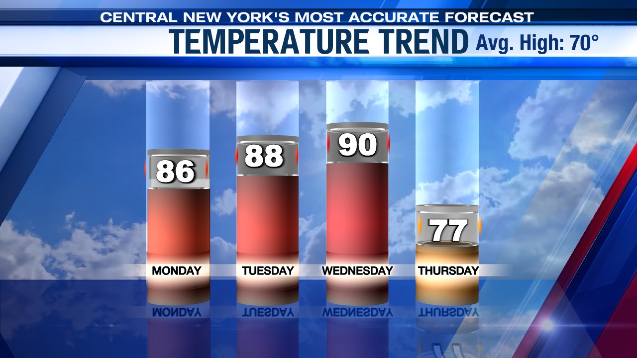
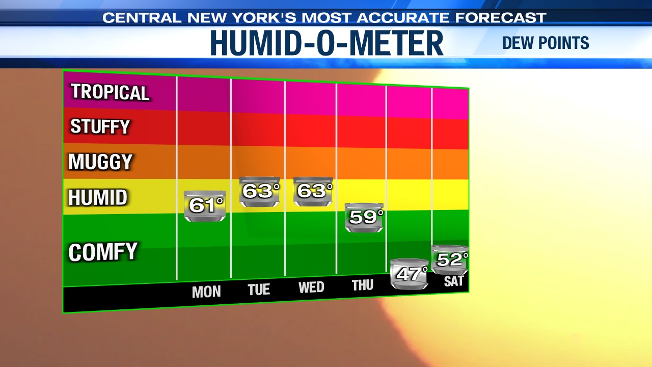
It will be an early taste of summer weather for Central New York. Check out the rising dew points through midweek below too…
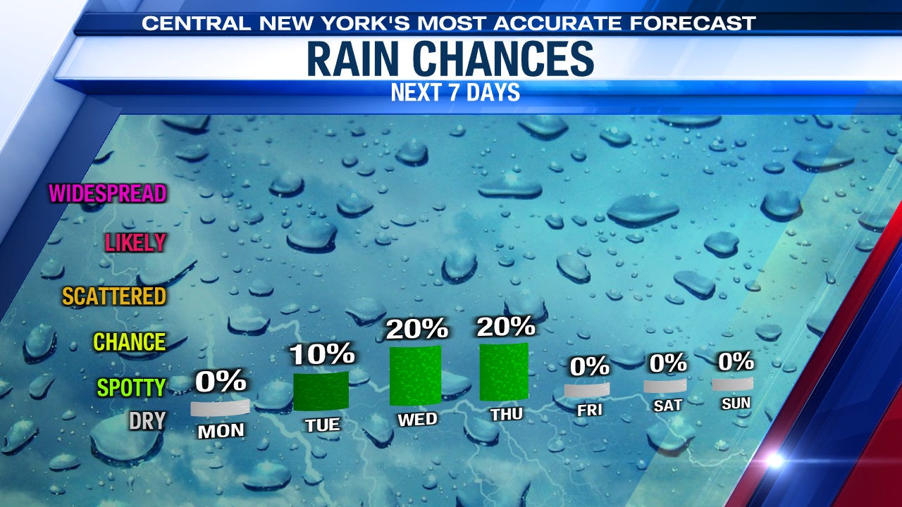
While there may be a spotty shower/storm or two Tuesday afternoon/evening, the next best chance of more widespread showers and storms won’t arrive until late Wednesday afternoon and or Wednesday night. The culprit of the showers and storms late Wednesday into the start of Thursday will be a cold front.
Ahh…for the last half of the week
In the wake of the Thursday morning cold front passage, it turns much cooler and less humid with a breeze come Thursday afternoon into Friday.
Highs should drop back into the mid to upper 70s Thursday with some afternoon sunshine after a few showers and possibly a storm or two kick off the day.
The coolest day of the week comes Friday with plenty of sun, a nice breeze and a more seasonable high in the low 70s.
Check out the latest 7-day forecast.