Early Saturday showers
SYRACUSE, NY (WSYR-TV) – The start of the weekend will feature some early morning showers, but drier weather is lined up for the rest of the day. Will we stay dry Sunday? Details below…
Early morning Saturday showers
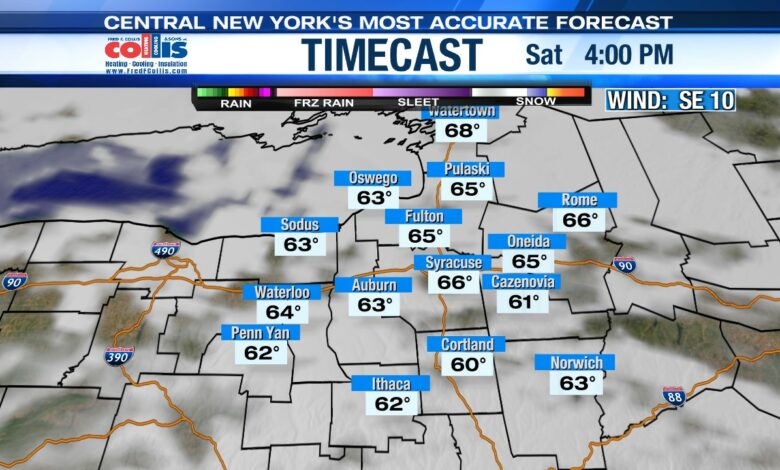
A weakening cold front will bring scattered light showers to the region early Saturday, but thankfully it won’t last long. As the front fizzles out, skies look to turn partly sunny by the afternoon. High temperatures on Saturday will reach the upper 60s to near 70. This will be perfect for anyone going downtown to Clinton Square today for the annual Crawfish Festival which runs from 11am until 7pm.

Sunday’s outlook
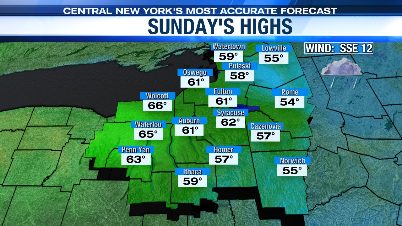
Sunday is looking to be the wetter of the two weekend days as an area of low pressure and cold front approach from the west. We can expect to see showers and some times of steadier rain to be with us, so plan accordingly for the Mountain Goat race!
It’s a breezy and cooler day too thanks to more clouds and the showers. Highs on Sunday will only make into the low 60s for Cinco De Mayo.
Sunny to start next week
High pressure will build into the Great Lakes region Monday pushing Sunday’s showers out of central New York. After a cloudy start with the slight risk of a morning shower, it turns out sunny in the afternoon. Monday is going to be noticeably warmer than Sunday with highs expected to be near 70.
That area of high pressure begins to weaken early Tuesday, but central New York is still dry with a mix of sun and clouds. Temperatures on Tuesday are expected to be warmer in the low 70s.
Mild and stormy Wednesday
An unsettled pattern of showers will begin Wednesday and last through the upcoming work week. The first area of low pressure will arrive Tuesday night bringing showers through central New York. As this disturbance lifts north, Wednesday afternoon should dry out before showers return for both Thursday and Friday. These showers are from another storm system that will track eastward. By Friday, the center of the storm system will be to our east, which will then provide a cooler northwesterly wind for Friday. This is why high temperatures Friday will be cooler in the mid 60s.
Check out the latest 7-day forecast.