A wet end to the weekend
SYRACUSE, NY (WSYR-TV) – Most got through Saturday essentially dry despite lots of clouds being around. Unfortunately, we are turning wet for the last half of the weekend. Details are below…
Have the umbrella handy
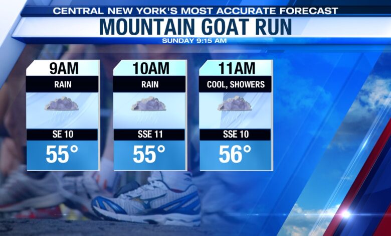
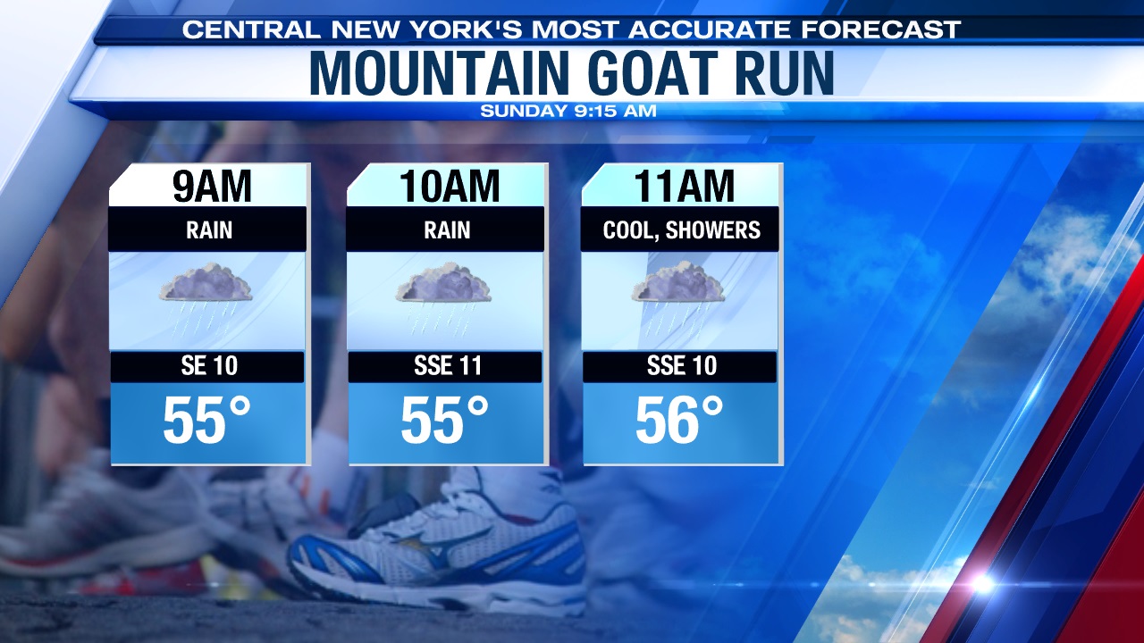
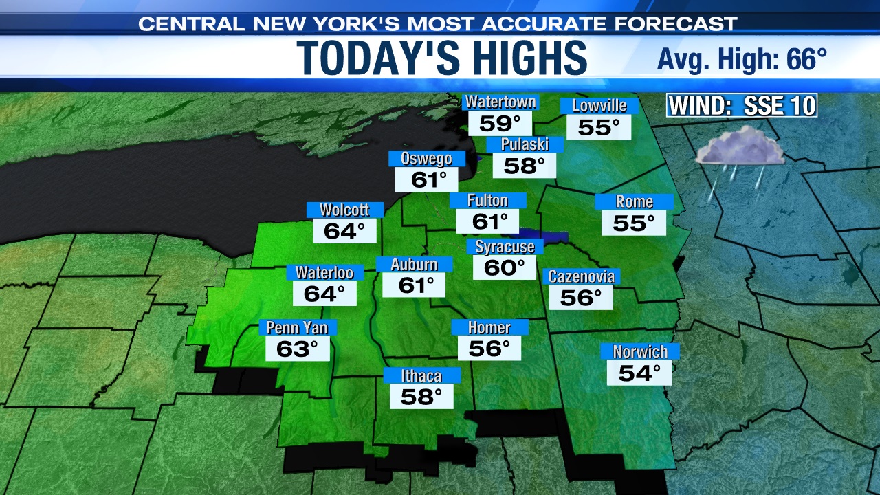
Some rain moves through today as an area of low pressure moves in from the south out ahead of a cold front approaching from the west. We can expect to see showers and periods of steadier rain to be with us through mid-afternoon, so plan accordingly for the Mountain Goat race if you are running or spectating this morning!
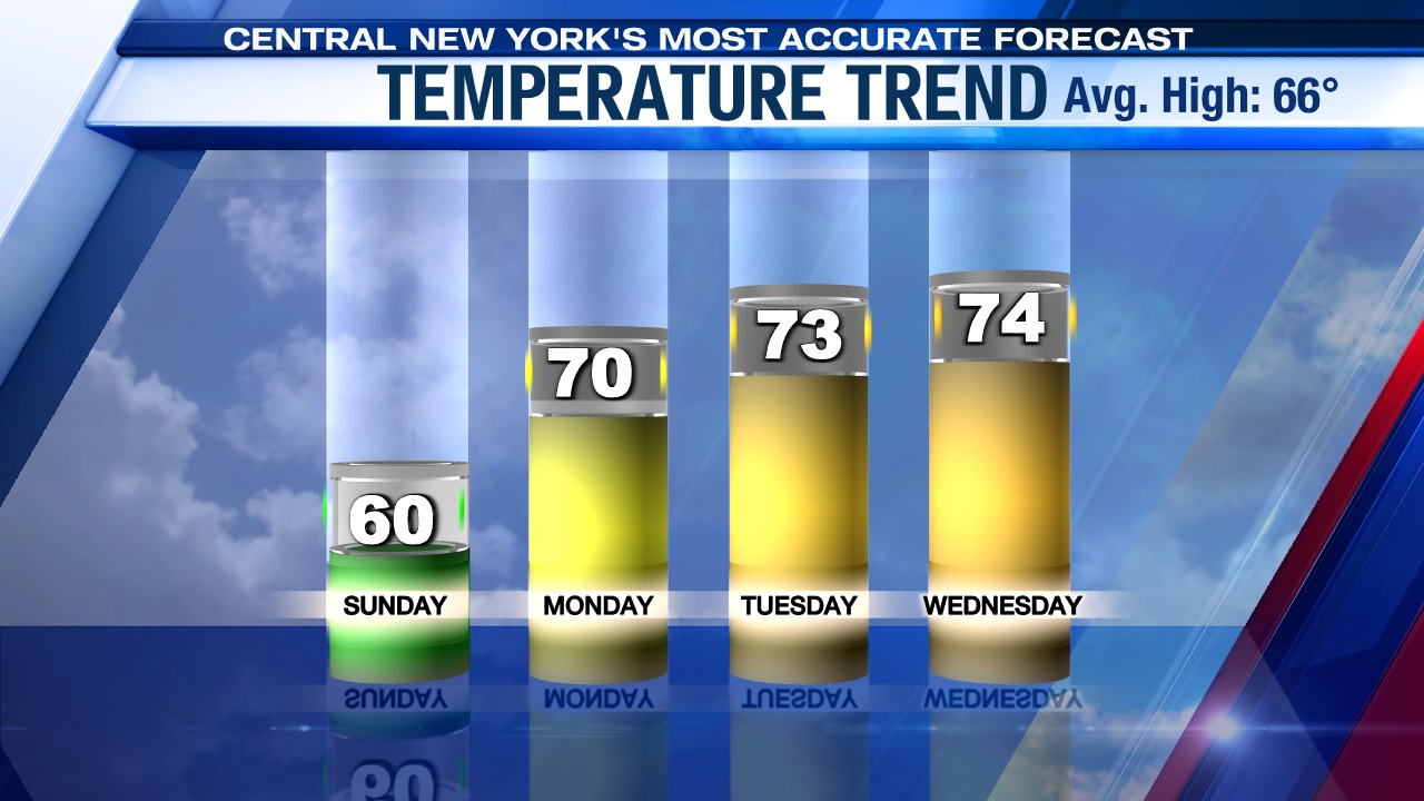
It’s a breezy and cooler day too thanks to more clouds and the showers. Highs on this Cinco Day Mayo occur early this evening as we turn drier after 3 or 4 p.m. with readings climbing well into the 50s to possibly 60, and if we are lucky we may see a few glimpses of the sun towards sunset.
Becomes nicer this week
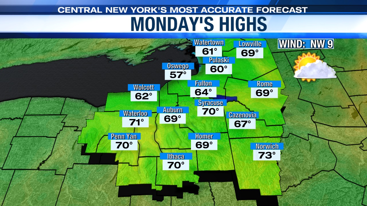
After a few more showers tonight and a lingering shower or two Monday, high pressure will build into the Great Lakes region Monday pushing Sunday’s showers out of central New York. It’s a cloudy start with a slight risk of a morning shower before 9 a.m., before turning sunny in the afternoon Monday. Monday is also going to be noticeably warmer than Sunday with highs expected to be near 70.
That area of high pressure begins to weaken early Tuesday, but central New York is still dry with plenty of sun. Temperatures on Tuesday are expected to be warmer too, rising into the low to mid 70s.
Cooler & damper changes later in the week
An unsettled pattern of showers will begin Wednesday and last through the last half of the upcoming work week.
The first area of low pressure will arrive late Tuesday night bringing showers through central New York. As this system moves east of us, we should turn drier later Wednesday afternoon before another round of showers returns for both Thursday and Friday. The showers late in the week are from yet another storm system that will track eastward into the Northeast.
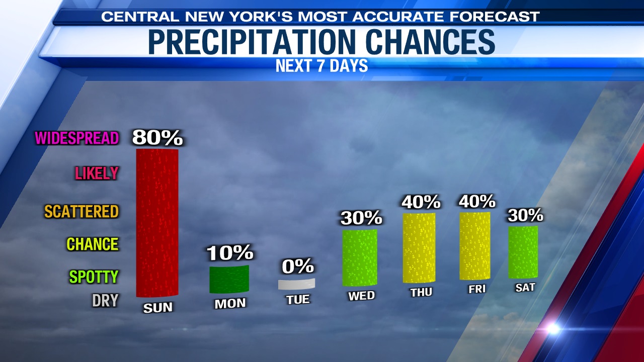
On Friday, the center of the storm system will slowly track to the east of the region, which will then provide a cooler northwesterly wind for Friday. This is why high temperatures Friday are expected to dip a bit below normal as readings cool into the low 60s.
Check out the latest 7-day forecast.