A few showers tonight, but improving Monday
SYRACUSE, NY (WSYR-TV) – Few showers overnight, otherwise much of the night is dry and will be followed by an improving Monday. Details are below…
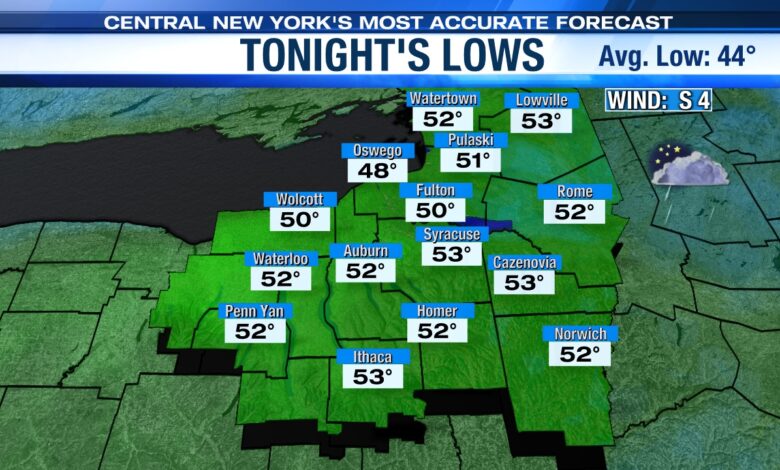
Few showers overnight
A weakening cold front likely produces a few passing showers across CNY mainly after 9 or 10 tonight with a mild low in the low to mid 50s. Also, watch out for areas of fog to develop overnight.
Turns nicer Monday into Tuesday
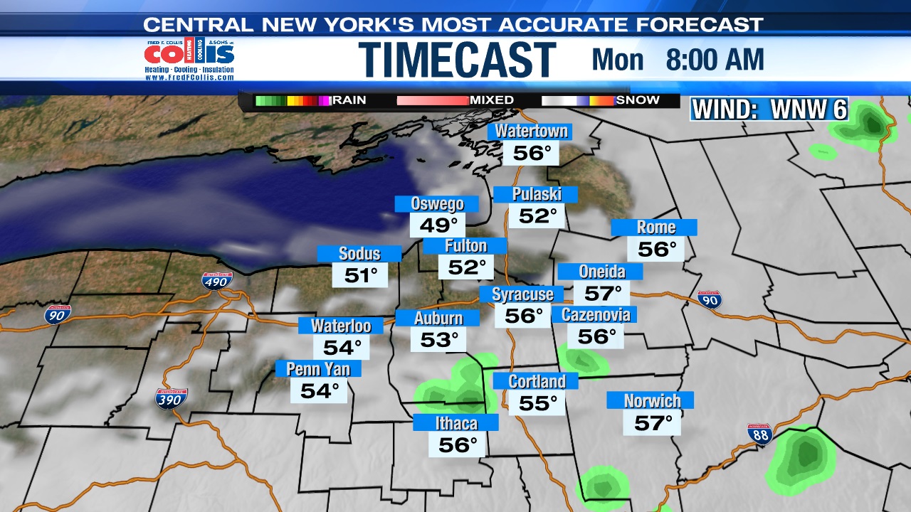
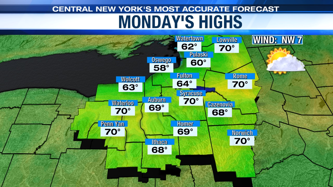
High pressure will build into the Great Lakes region Monday delivering drier air to central New York. It’s a cloudy start with a slight risk of a morning shower before 9 a.m. mainly south and east of Syracuse, before we turn partly to mostly sunny during the midday and afternoon.
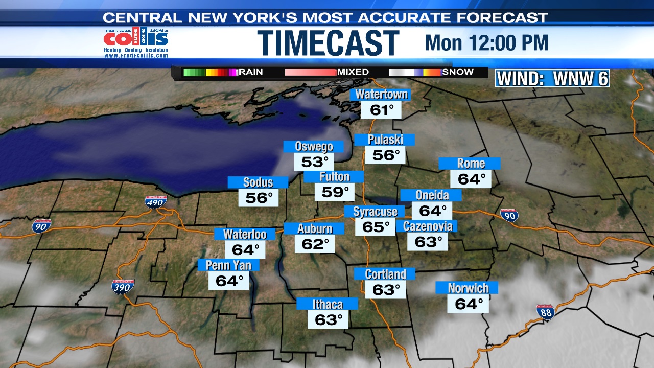
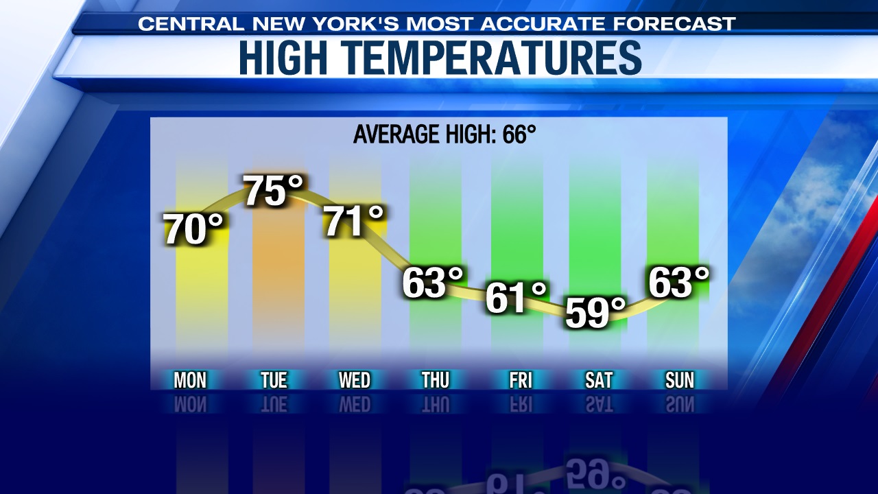
Monday is also going to be noticeably warmer than Sunday thanks to the developing sunshine with highs expected to be within a few degrees of 70.
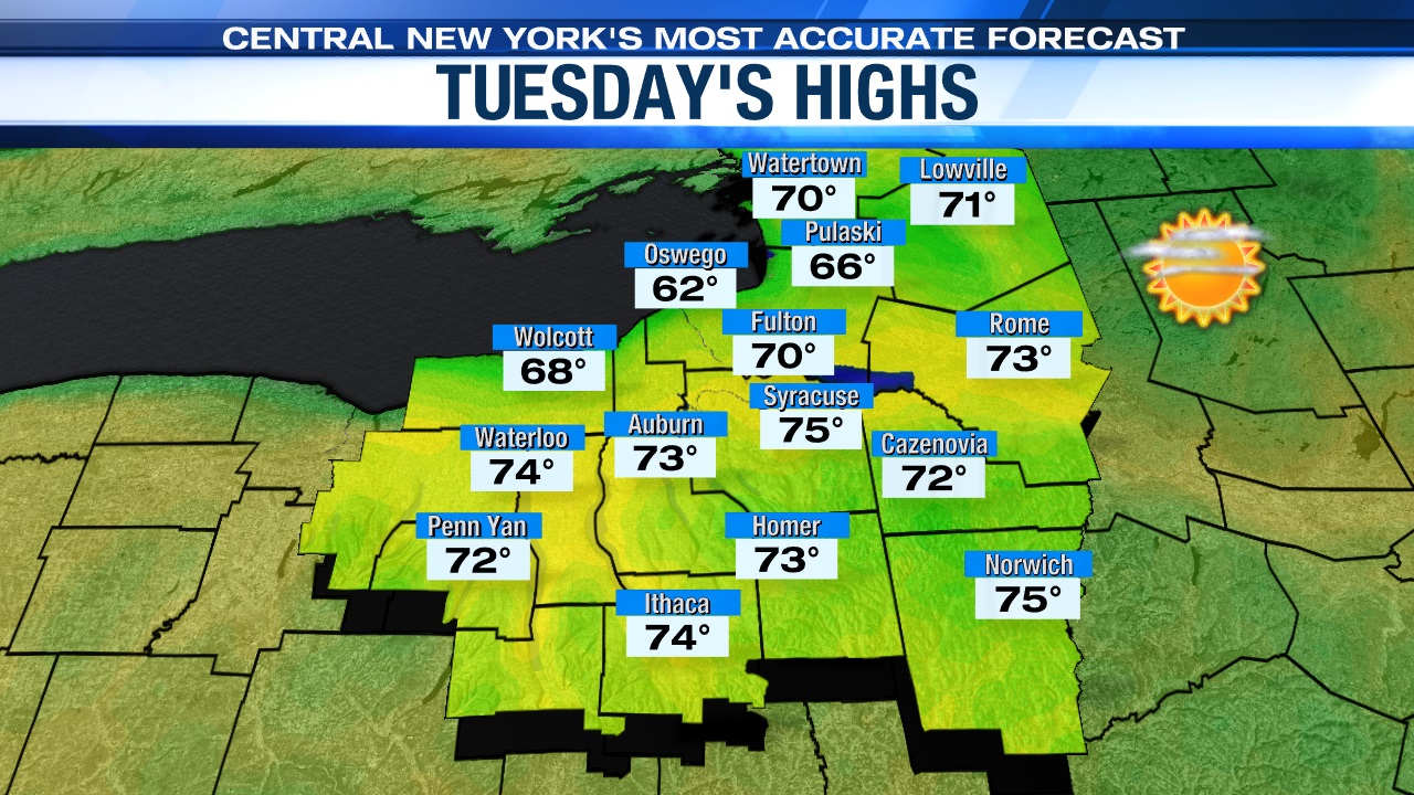
That area of high pressure begins to weaken early Tuesday, but central New York is still dry with plenty of sun. Temperatures on Tuesday are expected to be warmer too, rising into the low to mid 70s.
Cooler & damper changes later in the week
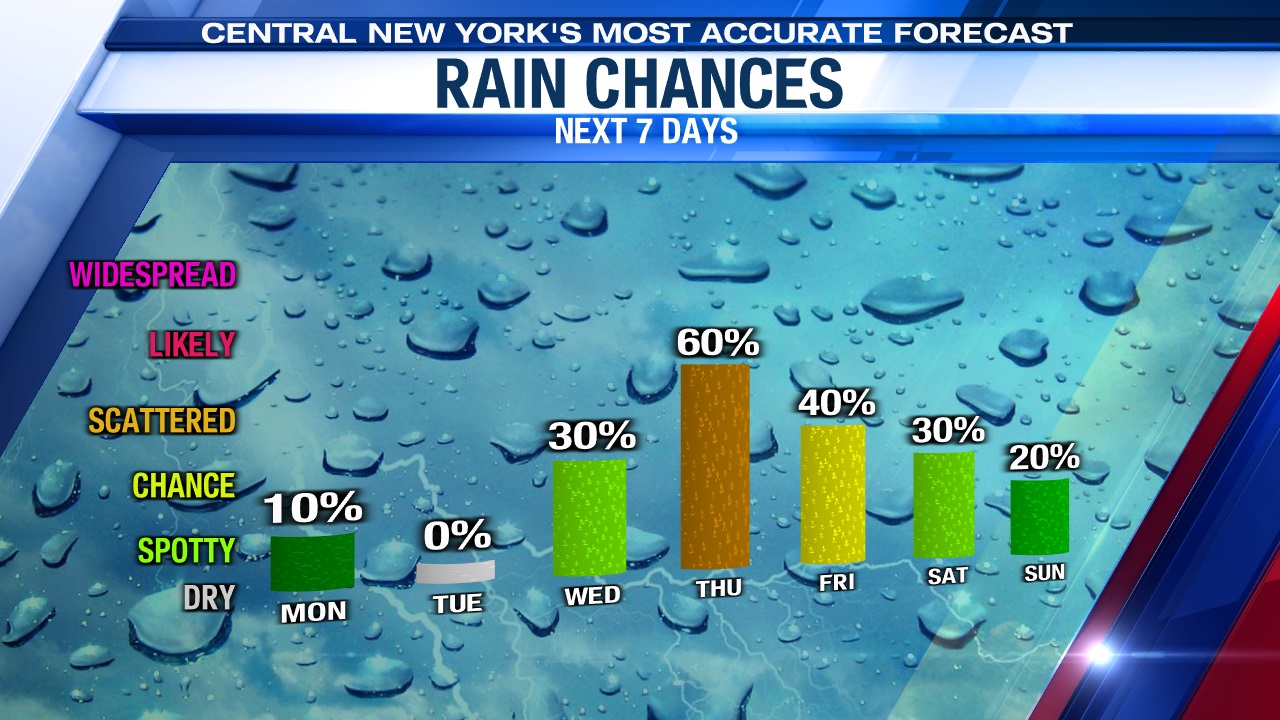
An unsettled pattern of showers will begin Wednesday and last through the last half of the upcoming work week.
The first area of low pressure will arrive late Tuesday night into Wednesday bringing showers and possibly a t-storm or two through central New York. As this system moves east of us, we should turn drier later Wednesday afternoon before another round of showers returns for both Thursday and Friday. The showers late in the week are from yet another, stronger storm system that will track into the Northeast.
The above-mentioned storm impacting the region the last half of the week is expected to not only bring some rain, but also unseasonably cool air. We think highs may struggle to reach the low to mid 60s Thursday and could be stuck in the 50s Friday!
Check out the latest 7-day forecast.