Warmer with a few showers and storms Sunday
SYRACUSE, NY (WSYR-TV) – Warmer air is finally here, but more showers are in the forecast. Details are below…
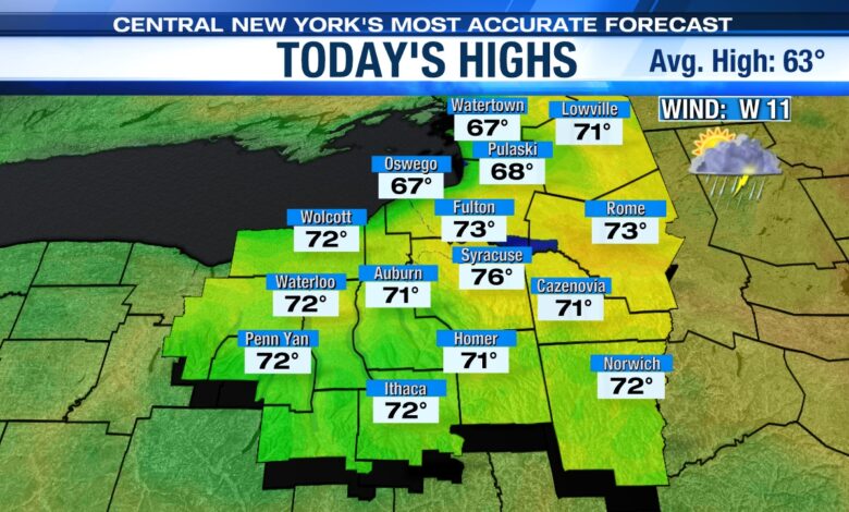
Warm and humid on Sunday
It looks even warmer on Sunday as a warm front moves through. Highs will be in the mid 70s as we close out the weekend.
Sunday starts with a mix of sun and clouds during the morning before our first chance of a shower near noon. Sunday afternoon looks to be our best chance for thunderstorms. For the first time this spring, you’ll also notice an increase in the humidity.
Not as warm Monday
We were hopeful for an 80-degree day on Monday, but the latest model guidance has a cold front coming out of the north from southern Ontario Sunday night into Monday. The best chance for temperatures reaching 80 now looks to be in Pennsylvania or maybe the Southern Tier of New York.
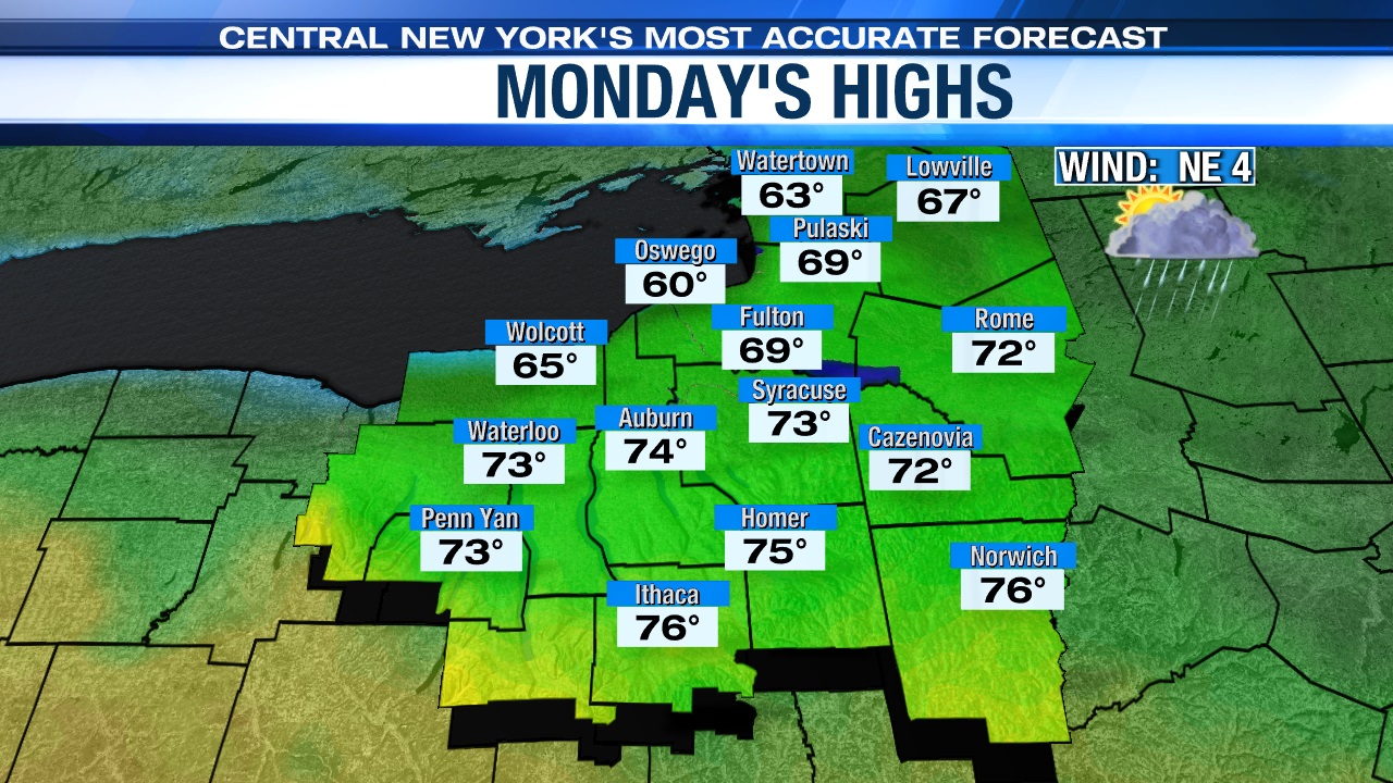
A few morning showers will give way to a mix of sun and clouds. Even though cooler air will be coming out of the north, that sun keeps us warm with highs on Monday still in the low to mid-70s.
Unsettled on Tuesday
A frontal system and low pressure in the Great Lakes region approach central New York throughout the morning into the afternoon on Tuesday. Showers and storms will develop and highs will reach the mid-70s.
Check out the latest 7-day forecast.