
Slow start, but nicer finish to Monday
SYRACUSE, NY (WSYR-TV) – Drier tonight across CNY, but does it last into the start of the new week? Find out below…
Drier start to the new week
As the fast-moving system moved out of CNY late Sunday afternoon/early evening, so too did the shower threat for the most part Sunday night into Monday as high pressure starts to build in.
The only fly in the ointment is a weakening cold front trying to slide in from the north. The front up north brings in more clouds overnight into Monday morning, and possibly a spotty shower or two mainly north and east of Syracuse during the morning. Come the afternoon, however, we believe high pressure wins out and a good deal of sunshine develops during the second half of Monday.
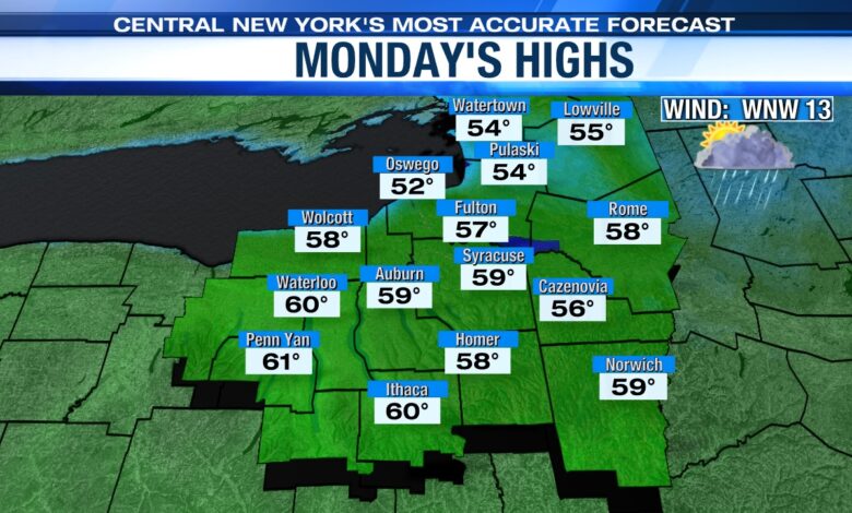
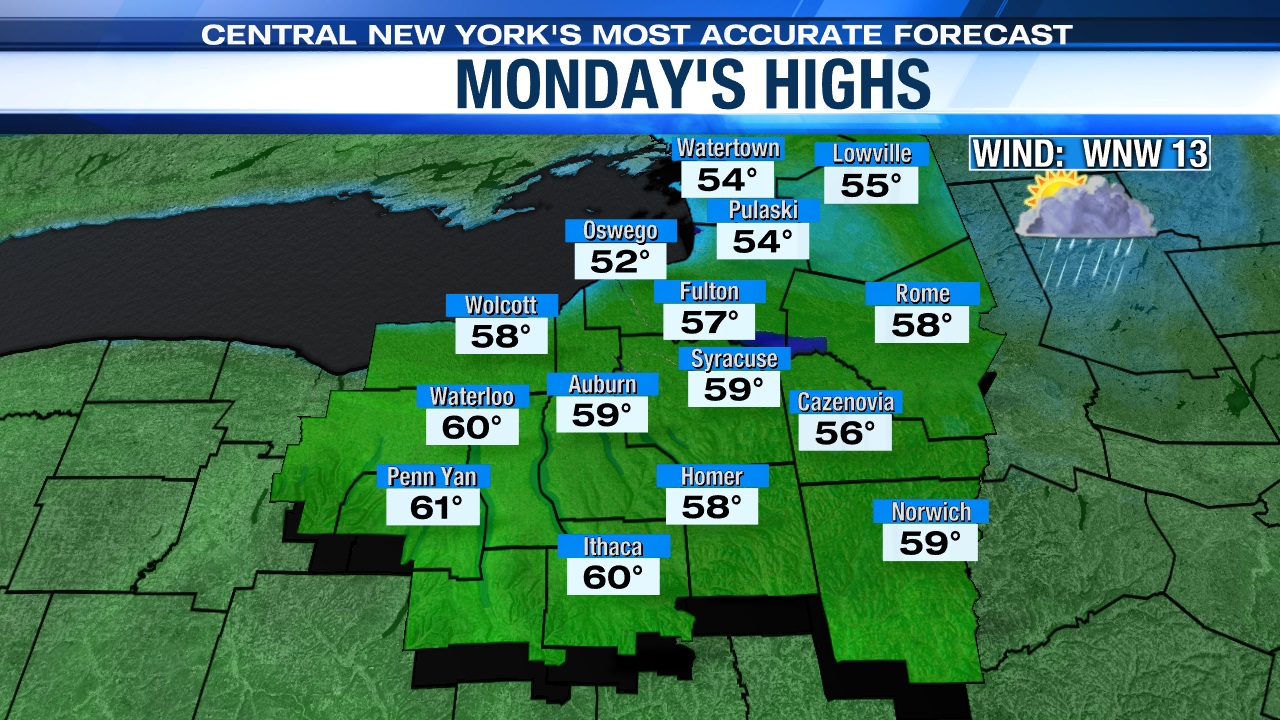
It’s pretty comfortable and remains slightly milder than average Monday with a steady, cool west-northwest breeze between 10 and 20 mph. Highs range from 55 to 60 to start the week.
Pick day of the week is…
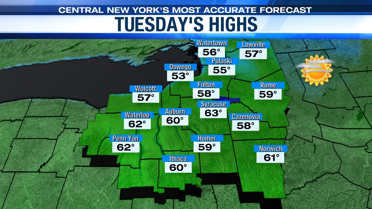
High pressure tracks south of us into central Pennsylvania on Tuesday with lots of sunshine expected and high temperatures rising into the low 60s and likely ends up as the pick day of the week.
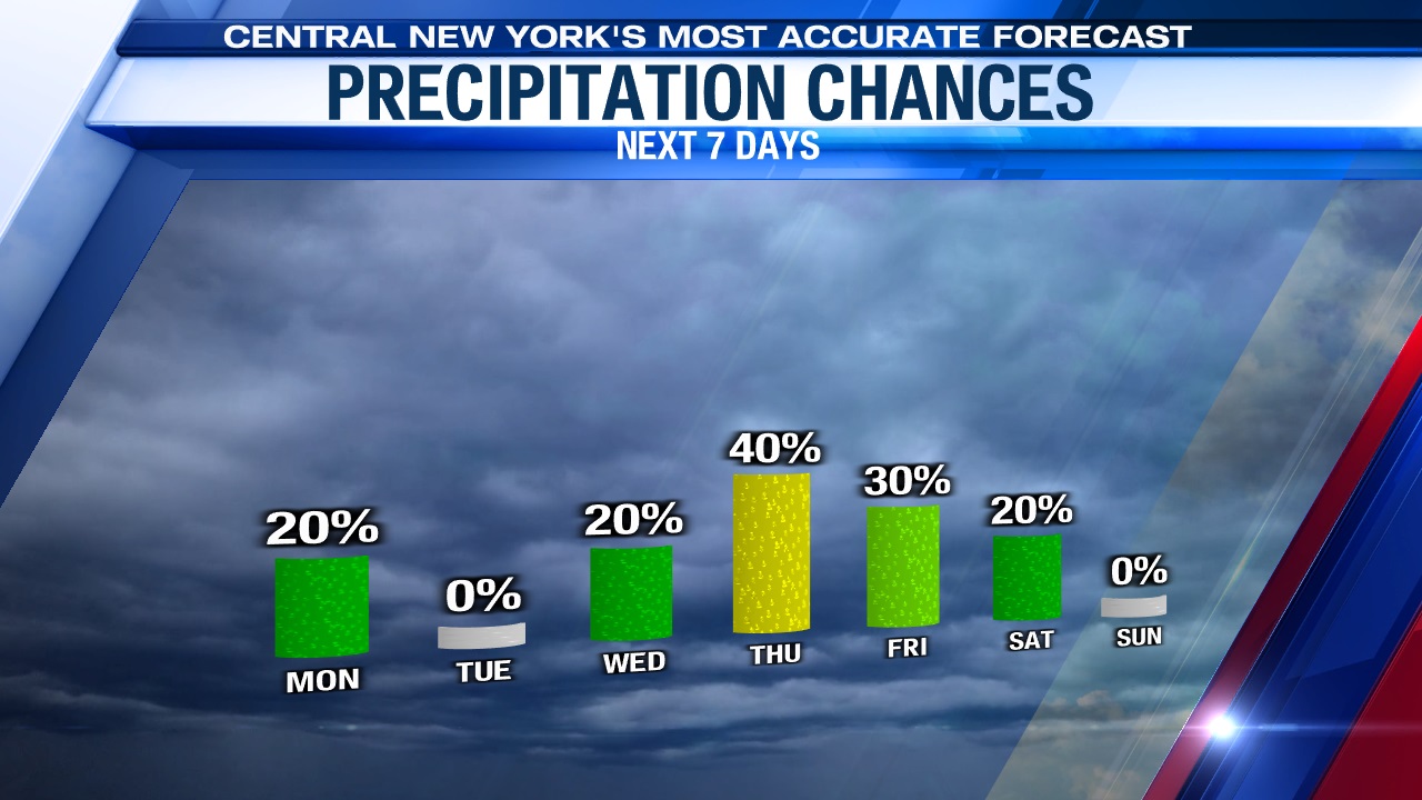
Rain chances return midweek
Wednesday starts cool and sunny but turns cloudier during the afternoon with a bit of rain trying to build in from the west after 3 or 4 pm in advance of a weakening storm system.
Highs Wednesday before the rain arrives should make the mid-60s.
It appears the dampest day of the week will be Thursday with a cooler high in the 50s to around 60.
Check out the latest 7 day forecast.


