
It’s mainly dry, but cool and breezy into Sunday
SYRACUSE, NY (WSYR-TV) – Mainly dry, cool conditions are in store to close out the weekend with a chance of…frost? Details are below…
Mainly dry end to weekend
High pressure building into southern Pennsylvania is keeping us mainly dry here in central New York on Sunday.
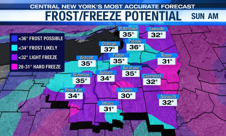
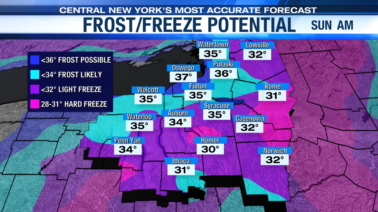
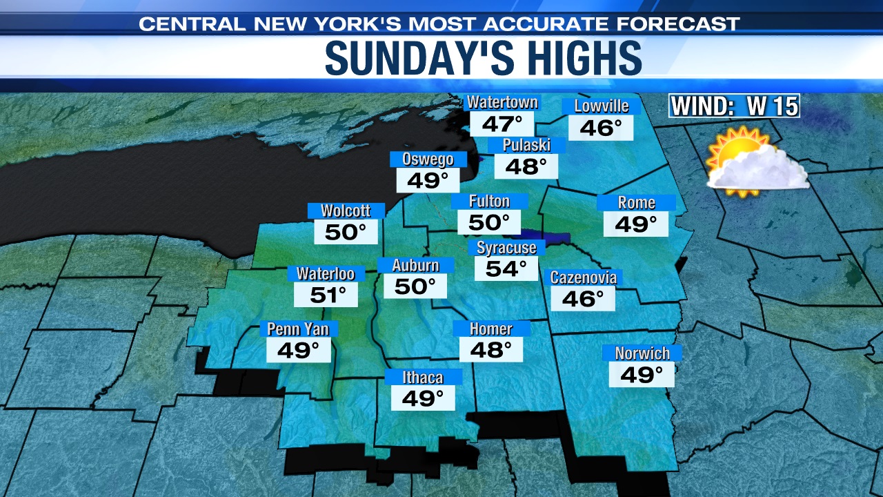
While we expect to feel the low 50s on Sunday for a high, we are also watching the risk for a bit of frost first thing Sunday morning in the normally chillier spots south and east of Syracuse where temperatures could get close to the freezing mark. This will probably be the first of several days this upcoming week with the possibility of frost.
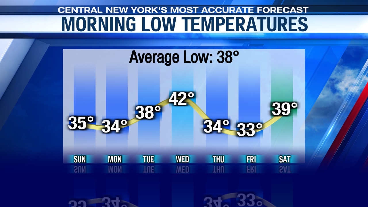
Check out the overnight lows for the next seven days below…
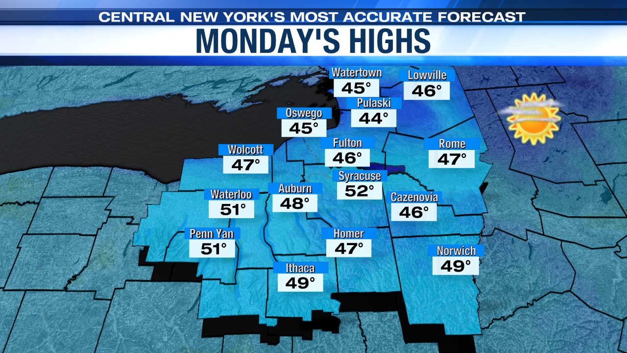
Sunny, but cool Monday
An area of high pressure will force cooler air south from Canada into central New York to begin the week.
While we are going to be sunny on Monday, that sun won’t help warm us up with highs only expected to be in the low 50s, which is several degrees below average for this time of year.
Mild on Tuesday, but…
That area of high pressure keeping us dry and sunny to start the week is forced eastward by a low pressure that sets up in the Great Lakes region. A warm front extends off that low pressure and moves through on Tuesday with a gusty south wind warming us up into the low to mid 60s on Tuesday.
The milder air we feel Tuesday won’t last though unfortunately because a cold front is expected to swing to start Wednesday with some rain showers expected near and after sunset Tuesday into Wednesday. This cold front will bring about a chilly, raw, and blustery midweek as highs likely struggle to get out of the 40s Wednesday and Thursday! Stay tuned for updates.
Check out the latest 7 day forecast.


