
Frosty for a few tonight; Nicer, but still cool Monday
SYRACUSE, NY (WSYR-TV) – Cool and quiet tonight into Monday, but will we see more in the way of sunshine to start the week compared to Sunday? Find out below…
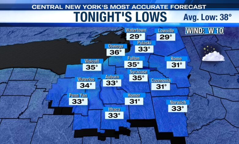
Chilly & quiet tonight
Clouds vary in coverage tonight with a breeze fairly steady which keeps temperatures higher than they otherwise would be.
Lows for most are in the mid-30s, but at or just below freezing in the normally chillier spots south and east of Syracuse and also across the North Country/Tug Hill where the best chance of some frost late tonight is.
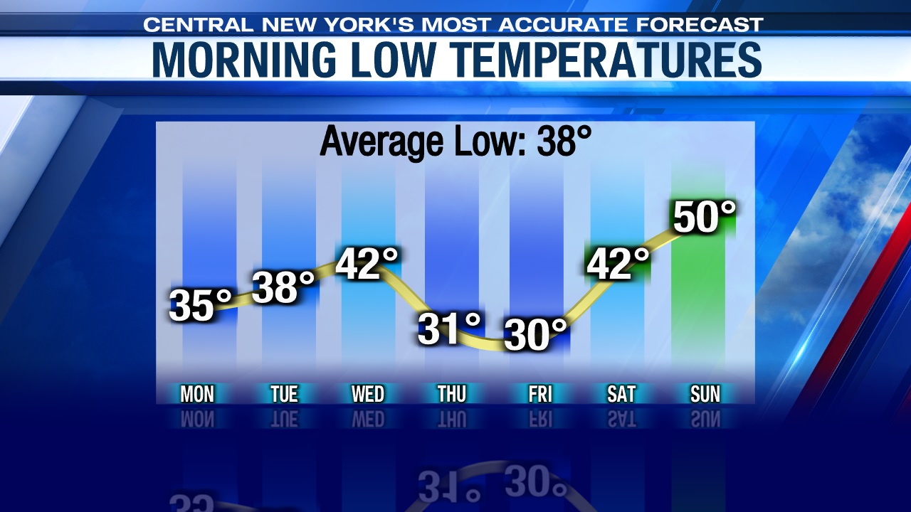
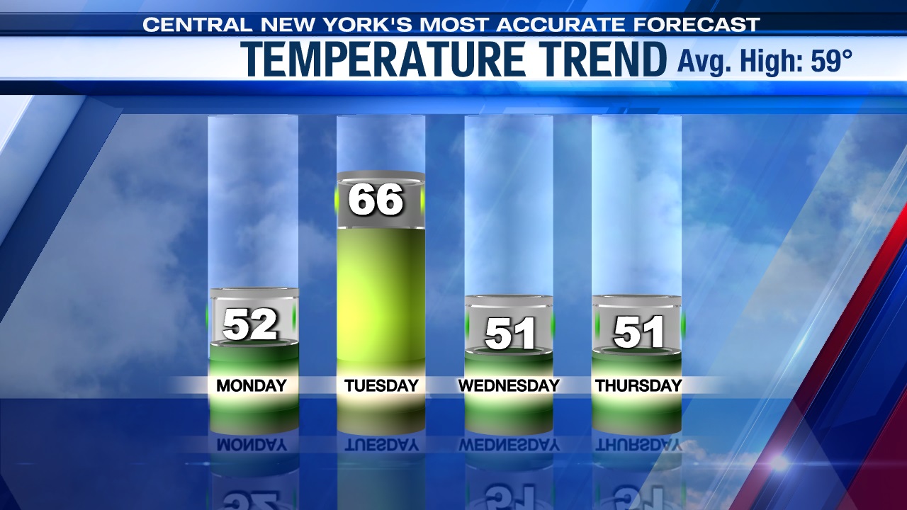
There’s a better chance for a widespread frost/freeze Thursday and Friday mornings as you can see below with the overnight lows over the next 7 days. Sorry planters, but we all know now is not the time to plant any sensitive vegetation. Mid to late May is safer if you can wait.
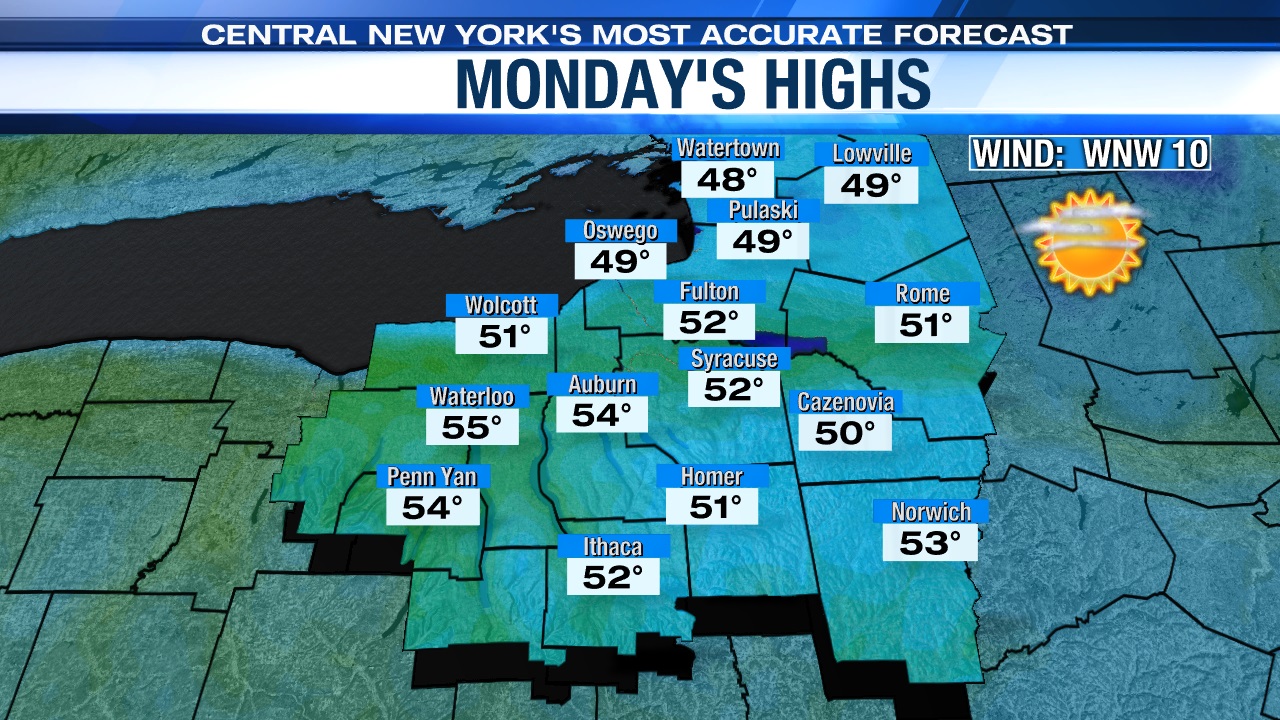
Cool, but sunnier Monday
An area of high pressure will force cooler air south from Canada into central New York to begin the week.
Note, near and south and west of Syracuse it appears there’ll be some lake clouds and possibly a passing rain/snow shower in the morning before the clouds dry up and sunshine wins out for all for the afternoon. Despite the abundant afternoon sunshine, though, highs will only manage to reach the low 50s, which is several degrees below average for this time of year.
Milder on Tuesday but..
High that brings us the sunny weather Monday is moving to our east Monday night. Meanwhile, low pressure is heading east out of the Great Lakes. This will drag a warm front through late Monday night/early Tuesday with a gusty southwest wind setting up. That should warm us back into the 60s with sun fading behind increasing clouds during the late morning and afternoon, and a few showers possible towards sunset.
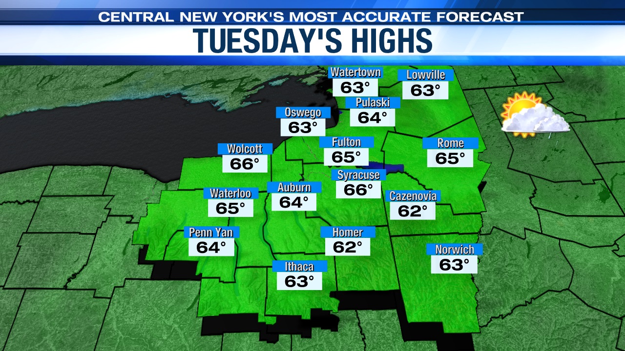
The milder air we feel Tuesday won’t last unfortunately because a cold front is expected to swing through central New York to start Wednesday. Showers ahead of this front first arrive close to sunset on Tuesday then continue through the first part of Wednesday before we dry out after 1 or 2 pm Wednesday.
In the wake of the cold front look for a chilly, raw and blustery midweek as highs struggle to get out of the 40s Wednesday and Thursday despite a good deal of sun expected on Thursday! Stay tuned for updates.
Check out the latest 7 day forecast.


