
Chill in store for the weekend
SYRACUSE, NY (WSYR-TV) – A wet start to Saturday followed by dry, cool conditions to end out the weekend with a chance of…frost? Find out below…
Wet start to Saturday
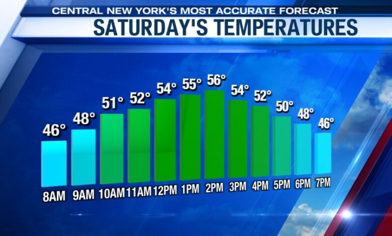
In the wake of Friday evening’s cold front, cooler air moves in and stays around for the weekend. It looks like temperatures Saturday will be in mid 50s. Our normal high by this point in April should be closer to 60.
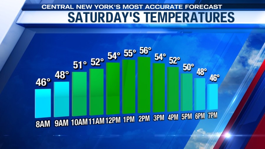
There does appear to be a several hour stretch Saturday afternoon where clouds build and there could be some brief rain showers. Keep an eye on the radar if you have outdoor plans during this time.
Dry end to weekend
High pressure builds in southern Pennsylvania keeping us dry here in central New York on Sunday. While we’re drier to end out the weekend, temperatures are expected to be a touch cooler than Saturday’s with highs in the low to mid 50s.
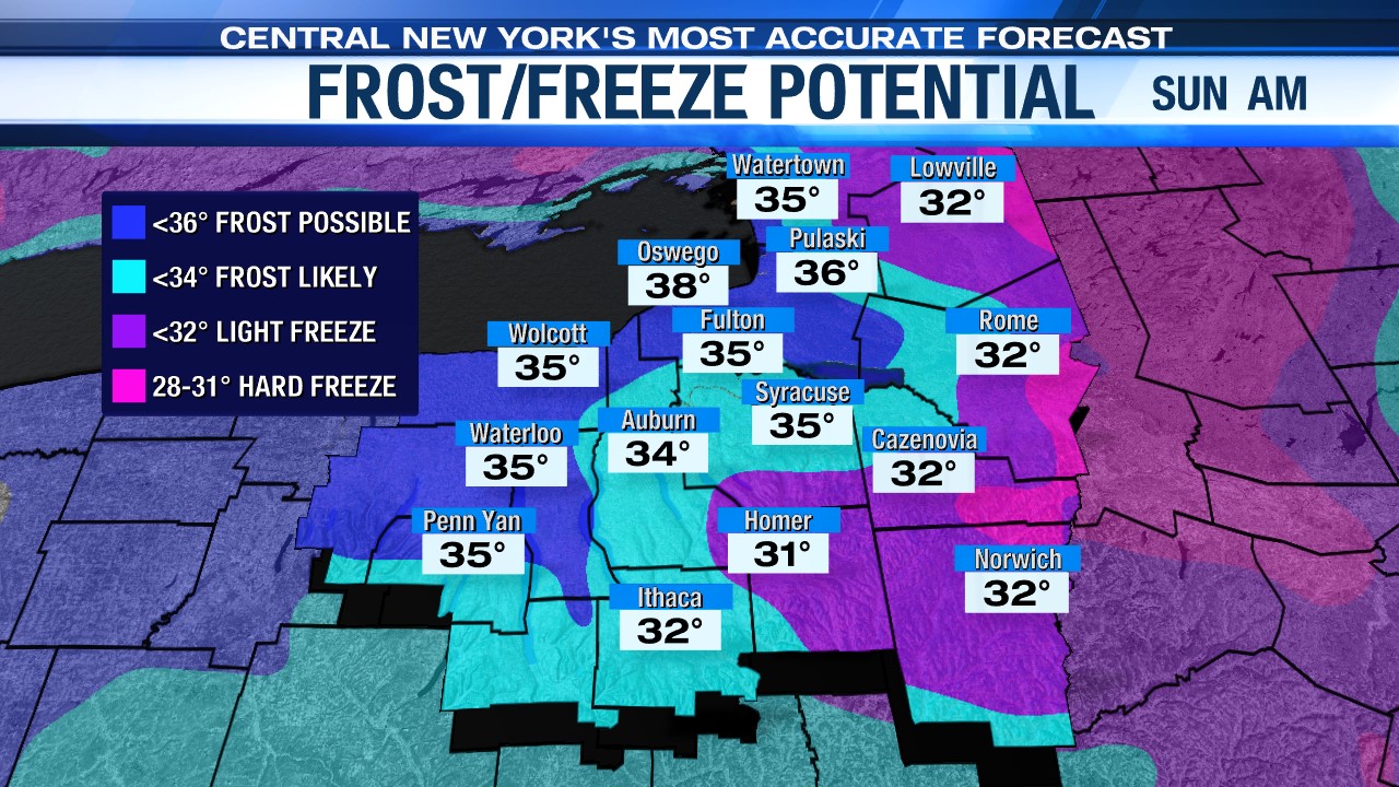
While we’re in the 50s Saturday and Sunday, we are also watching the risk for frost on Sunday morning as temperatures get close to the freezing mark. This will probably be the first of several days this upcoming week with the possibility of frost.
Cool, but sunny Monday
A region of high pressure will force cooler air south from Canada into central New York to begin the week. This should help keep us dry and sunny until Tuesday where a low to the west in the Great Lakes region will bring rain back to our area.
While we are going to be sunny on Monday, that sun won’t help warm us up with highs expected to be in the low 50s, which is nearly 8 degrees below average for this time of year.
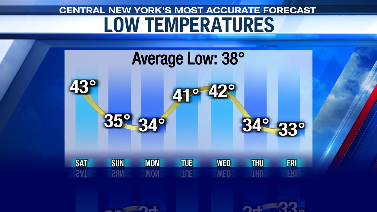
Check out the latest 7 day forecast.


