Turning cooler with low shower threat tonight
SYRACUSE, NY (WSYR-TV) – The nicer, spring feel to the air this week is coming to an end. How cool is going to get as we head towards the holiday weekend? Find out below…
Cooling back down…
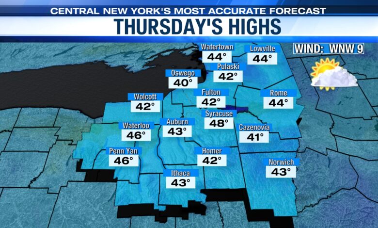
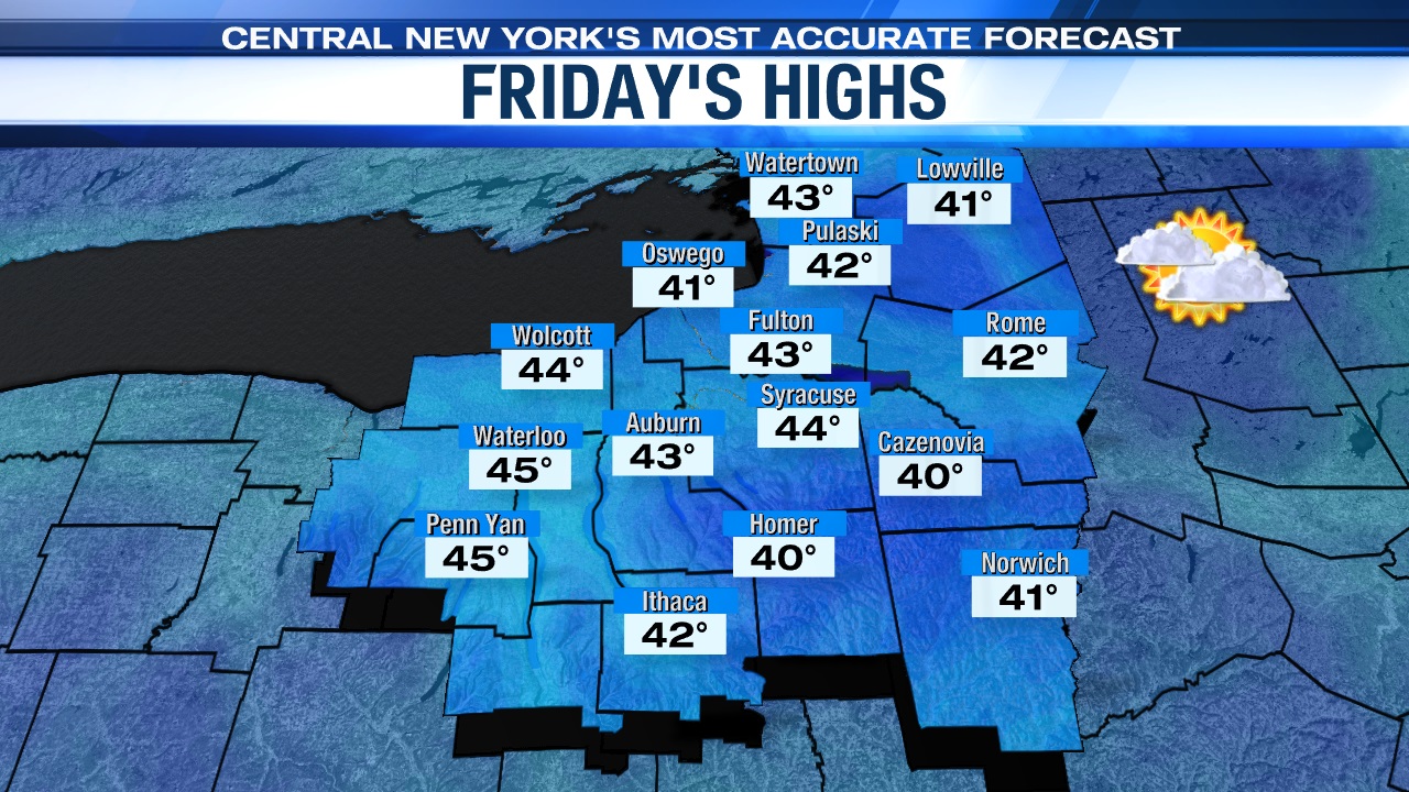
A cold front sliding through Wednesday evening is knocking temperatures back down to more seasonable levels, low 30s by night and mainly 40s by day, the rest of the week.
Little no precipitation the rest of week
The best chance of any showers the rest of the week appears to be tonight, especially this evening as a cold front slowly slides through. There may also be some sprinkls/flurries around on Friday, but other than that it looks to stay dry the remainder of the week.
Rainfall amounts through the end of the week across CNY is going to be minimal at best with a 0.10″ or less.
Will the cooler temperatures and mainly dry conditions continue into Easter weekend? Click here to find out.