Spring flips back to winter this weekend in CNY
SYRACUSE, NY (WSYR-TV) – It has felt like spring this first week of March in central New York, but we expect a rude awakening later this weekend.
Rain to start the weekend, not snow
Some rain is expected on Saturday over central New York. It is steadiest in the afternoon. No travel problems are expected because of the rain on Saturday as temperatures are in the 40s to near 50.
When does the snow start?
Rain starts to change to snow for some as early as Saturday night.
The snow will first fly over higher elevations, but pretty much the entire region should have snow falling by midday Sunday, including lower elevations like the city of Syracuse.
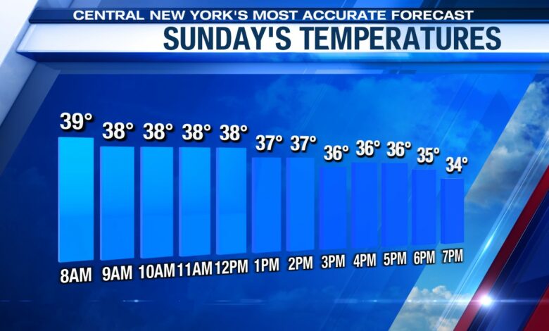
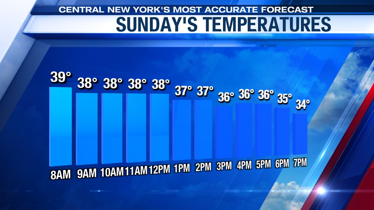
Accumulations of snow will be hard to come by in lower elevations Sunday because temperatures are above freezing. In fact, roads in the lower elevations should stay wet and not white through sunset Sunday (which actually comes just after 7 pm because of Daylight Saving Time).
Over higher elevations there could be a couple of inches by days end Sunday.
How much snow?
The worst stretch of weather (the combination of snow and strong northwest winds greater than 40 mph) comes Sunday night.
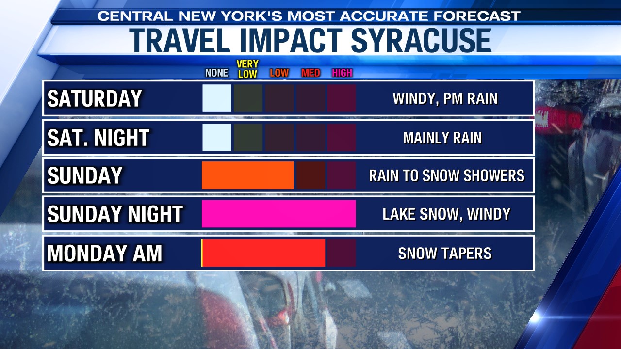
Road conditions should be difficult right through the morning commute Monday due to the snow and blowing snow.
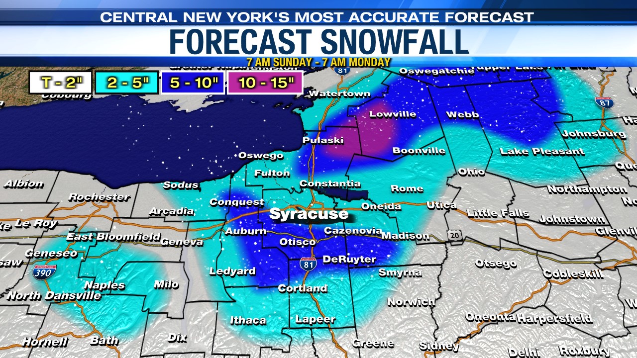
The greatest snow totals come over higher elevations south of Syracuse and closer to the Tug Hill where 5-10 inches is expected with some locally higher totals in the northern Tug Hill. The 5–10-inch snowfall area ends up in communities not too far south of the city of Syracuse like Marcellus, Lafayette, Jamesville and Manlius.
The snow quickly tapers close to noon Monday, but the wind remains gusty through the day.