Snow has returned but what happens next in CNY?
SYRACUSE, NY (WSYR-TV) – The calendar may say we are several days into spring, but Mother Nature has other ideas for central New York.
When is the worst over?
There is still some steady snow to deal with Saturday morning, even in areas that saw a wintry mix overnight. The trend, however, is for the snow to wind down toward the middle of the day.
Even before the snow ends road conditions improve first as temperatures approach and rise above freezing and then as the snow intensity comes down.
It is a mostly cloudy and dry afternoon for most with little if any travel issues.
How much snow falls?
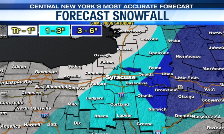
New snow Saturday morning will be on the order of 1 to 3 inches for much of CNY with higher amounts of 3 to 6 inches where the snow lasts the longest east of Syracuse.
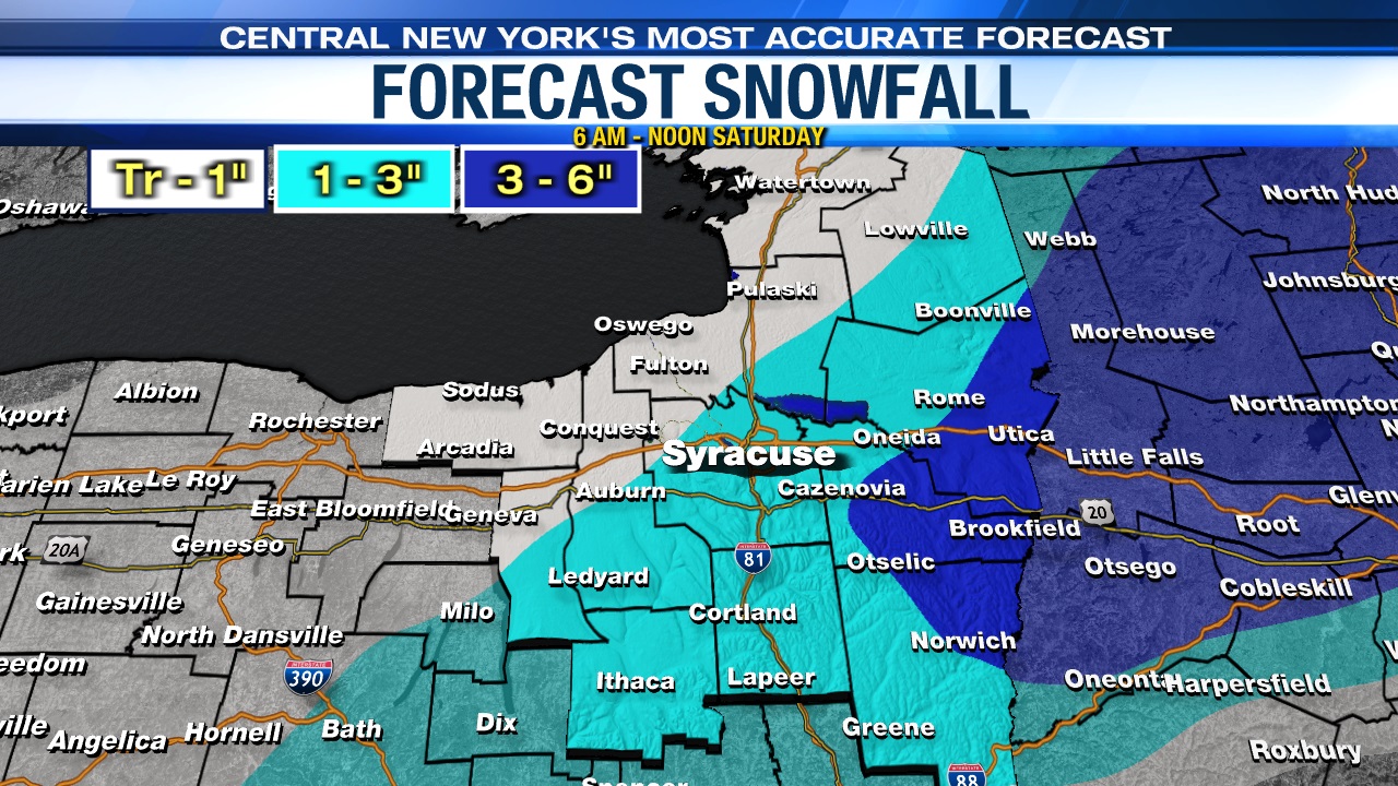
By the time all is said and done midday, snow totals could be 8-12” northeast of Syracuse and in particular from the Tug Hill into the Adirondacks. A widespread 4-8” of snow falls over a large part of the rest of central New York including Syracuse.
Farther south, including southern Onondaga County and closer to the Southern Tier will have more of a snow/sleet/freezing rain mix and perhaps even just some plain rain which keeps snow totals down.
Any good news this weekend?
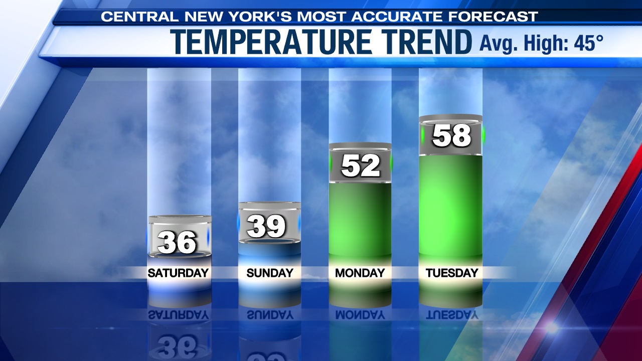
The sun is out for Sunday making for a nicer end to the weekend.
Running the Syracuse Half Marathon Sunday morning? It’ll be a cold, but sunny one! Temperatures will be below freezing during the race. Highs will rebound into the 30s in the afternoon.
Even warmer weather is in store early next week.