Marching back to winter’s cold, snowy weather
SYRACUSE, NY (WSYR-TV) – Well… false spring was nice while it was here. Now we’re slipping back to some wintry weather with colder air and accumulating snow all week. Details below…
Turning colder, more snow on the way
Hope you didn’t put away the winter coats, snowbrushes, gloves, and boots. We’ll need them again this week. A stretch of chilly and snowy weather settles back over CNY this week.
High temperatures this week will only be in the 30s to near 40 all week long with wind chills in the 20s.
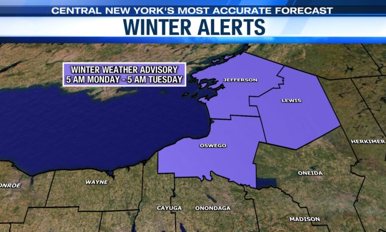
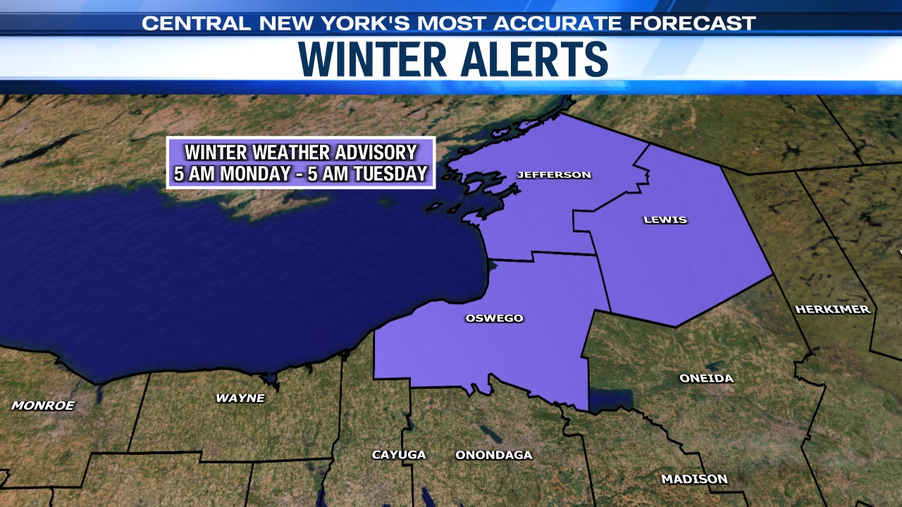
The focal point for developing lake effect snow showers Monday through Tuesday morning will be east of Lake Ontario, particularly for the Tug Hill Plateau. A Winter Weather Advisory is in effect for the counties east of Lake Ontario from Monday through 5 a.m. on Tuesday.
By Monday afternoon, scattered snow showers will be fair game across the rest of the area.
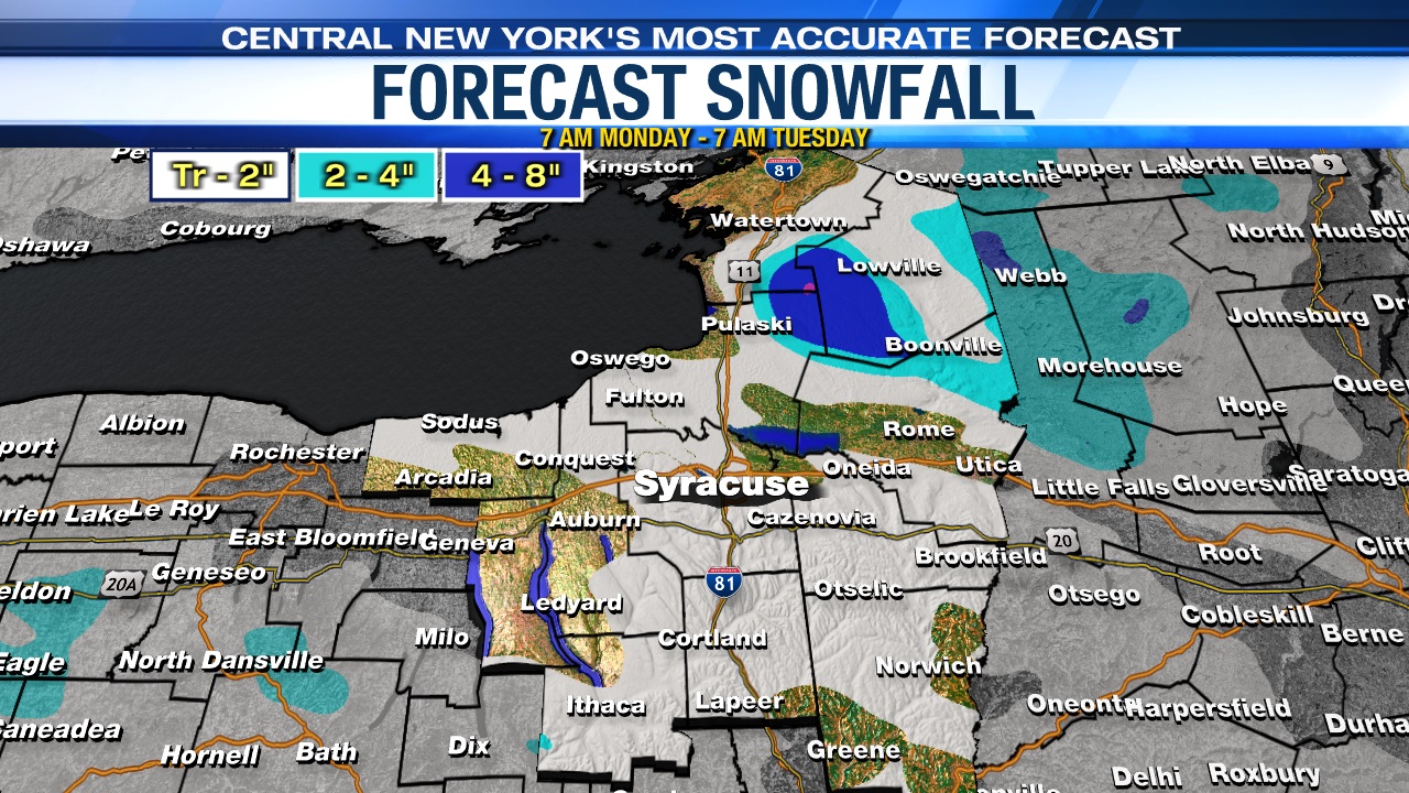
While a few snow showers are possible for many spots Monday night into Tuesday, the most persistent snow will remain over the Tug Hill through Tuesday morning. Total snow accumulations will be on the order of 4 to 8 inches, while amounts of a coating to an inch or two will be found elsewhere.
Occasional snow showers and areas of lake snow most likely continue at times right through at least midweek as spring officially starts at 11:06 p.m. Tuesday ironically!
Stay tuned for updates.