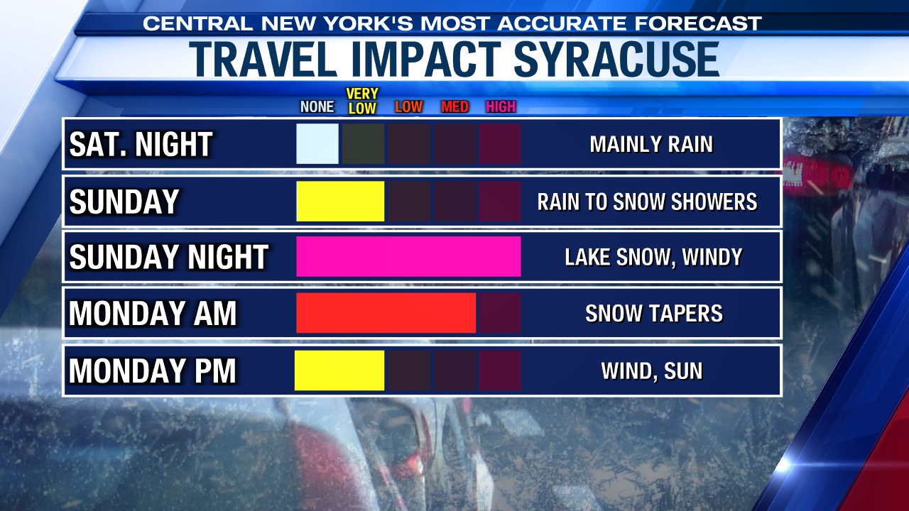
Mainly rain tonight, but wind & snow are on the way
SYRACUSE, NY (WSYR-TV) – It has felt like spring this first week of March in central New York, but we expect a rude awakening to finish out the weekend.
Rain now, but changes are on the way…
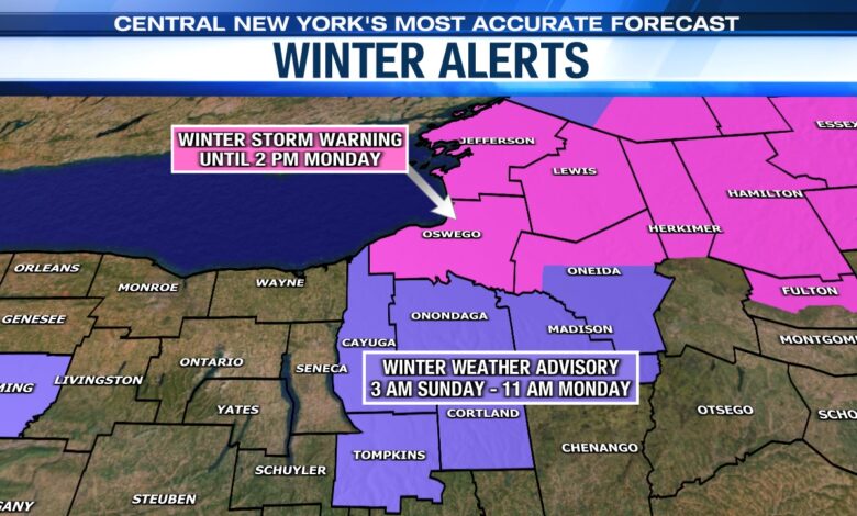
Due to winds ramping up and winter returning with some accumulating snow there are wind and snow alerts in effect across much of CNY.
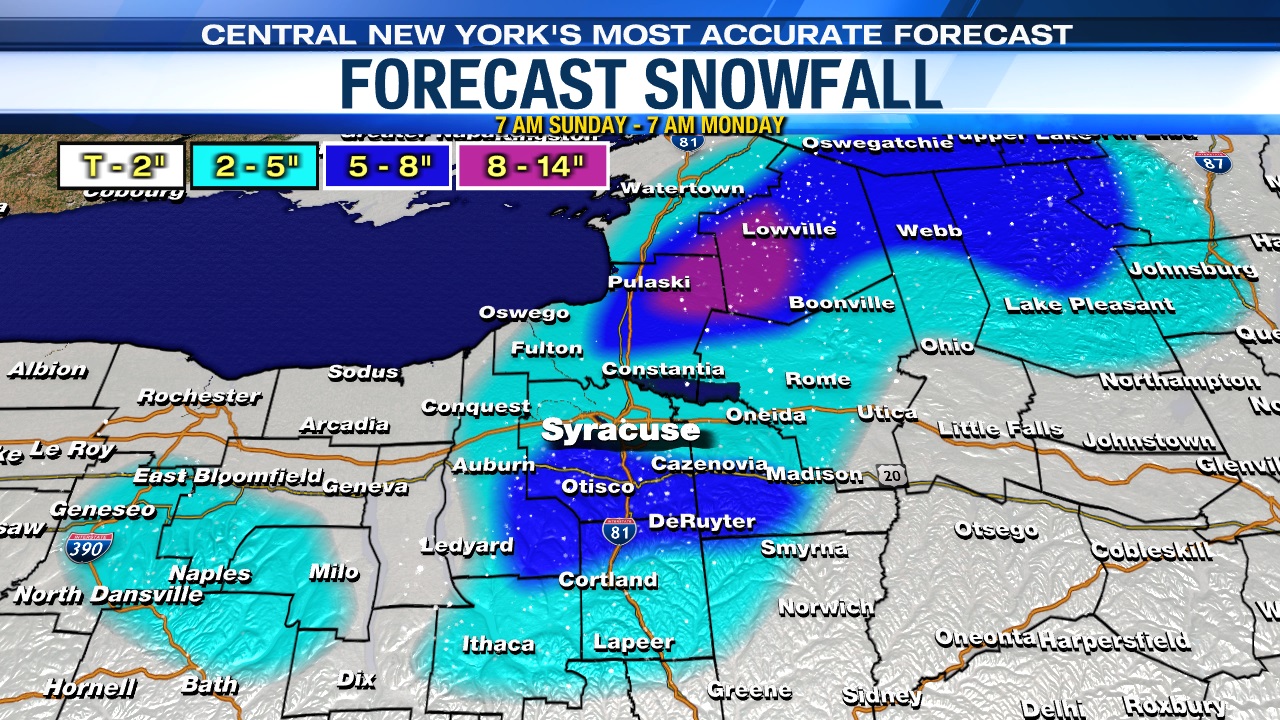
Winter Storm Warnings are in effect for Jefferson, Oswego, Lewis and Northern Oneida counties into Monday, mainly in and around the Tug Hill with significant snowfall expected.
Winter Weather Advisory is in effect across the eastern Finger Lakes, including Syracuse Sunday into the start of Monday with lesser, but still impactful snow expected.
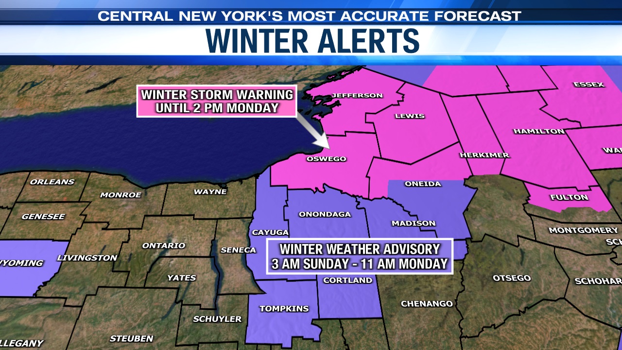
Lastly, a Wind Advisory is also in effect for much of CNY, including Syracuse, due to winds expected to gusts up to 45 or 50 mph at times Sunday night into Monday. These kind of winds will produce some blowing and drifting snow, greatly reduce visibility at times and possibly cause a few power outages too.
When does the snow start?
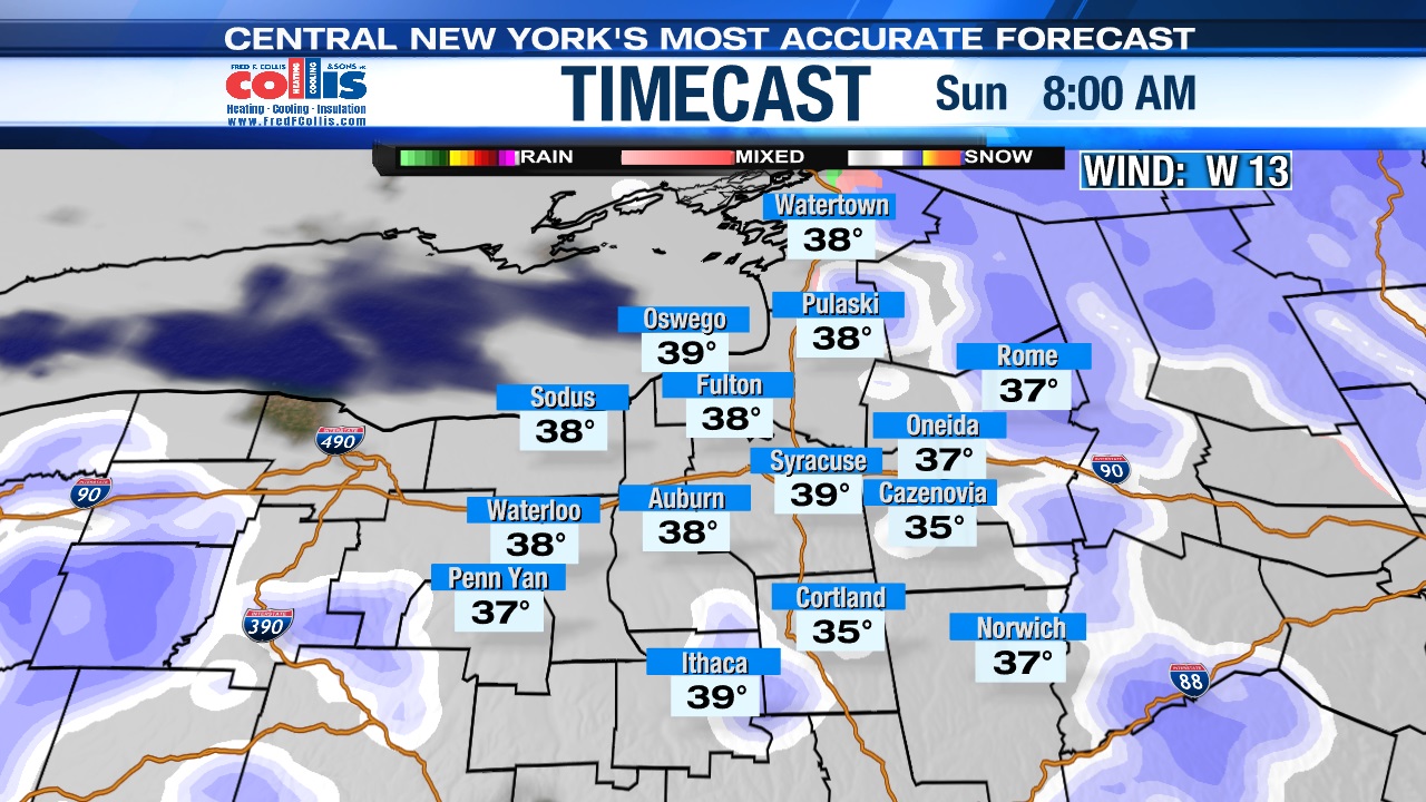
Rain starts to change to snow for some as early as late tonight, near and after midnight.
The snow will first fly over higher elevations, but pretty much the entire region will have snow showers falling by midday Sunday, including lower elevations like the city of Syracuse.
Accumulations of snow will be hard to come by in lower elevations Sunday because temperatures are above freezing. In fact, roads in the lower elevations should stay wet and not white through about sunset Sunday (which actually comes just after 7 pm because of Daylight Saving Time).

Over higher elevations there could be a couple of inches by days end Sunday.
How much snow, and when are conditions the worst??
The worst stretch of weather (the combination of snow and strong northwest winds greater than 40 mph) comes Sunday night.
Road conditions should become pretty slick/sloppy Sunday night after sunset into at least the start of the morning commute Monday due to the snow and blowing snow.
The greatest totals come over higher elevations south of Syracuse and closer to the Tug Hill where 5-8 inches is expected with some locally higher totals up across the Tug Hill. We think the 5–8-inch snowfall area ends up in communities not too far south of the city of Syracuse like Marcellus, Skaneateles, Onondaga Hill, Lafayette, Jamesville and Manlius.
The snow quickly tapers Monday morning, but the wind remains gusty, 40+ mph, through the day with some sun probably developing come the afternoon.
Highs on Monday should get up to near 40 with enough sunshine.
Powered by News Channel 9.