
Mainly dry & cool tonight, but what about Easter?
SYRACUSE, NY (WSYR-TV) – The weather looks to improve Easter Sunday after a slow start, but unfortunately the improvements on Easter Sunday likely won’t last. Find out more below about the unsettled changes ahead…
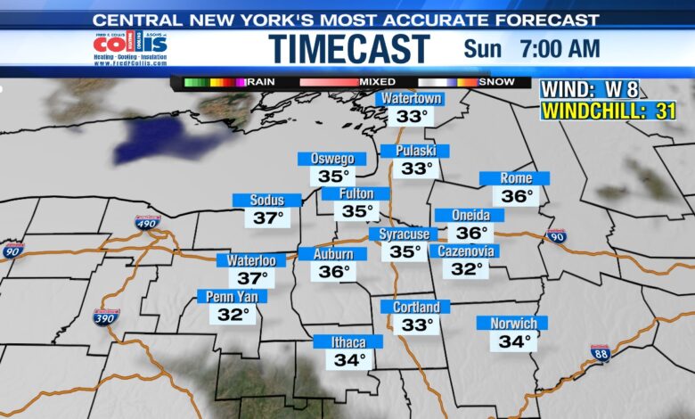
Seasonably cool Easter Day, but are we dry?
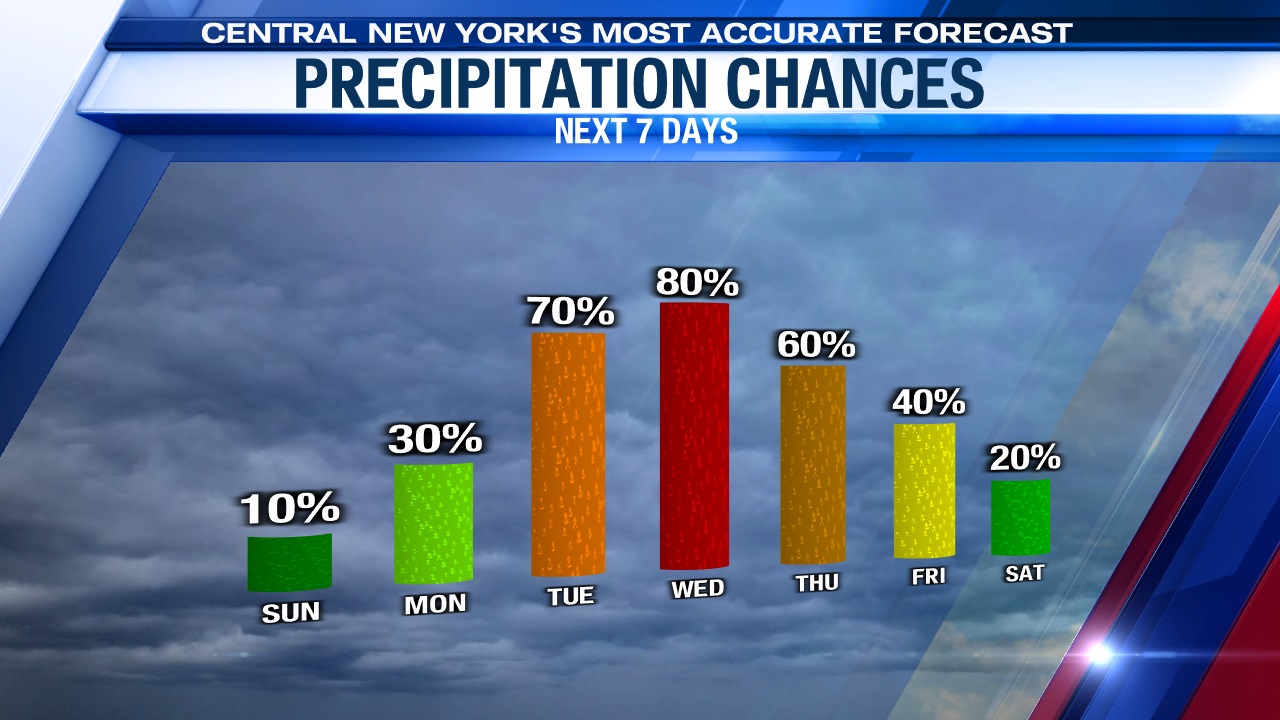
Sunrise Easter church services may have to contend with some flurries/sprinkles or a spotty rain/snow shower, but those are expected to taper off just after Sunday services.
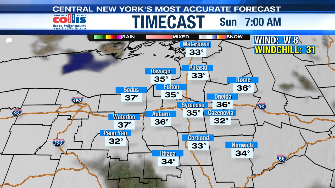
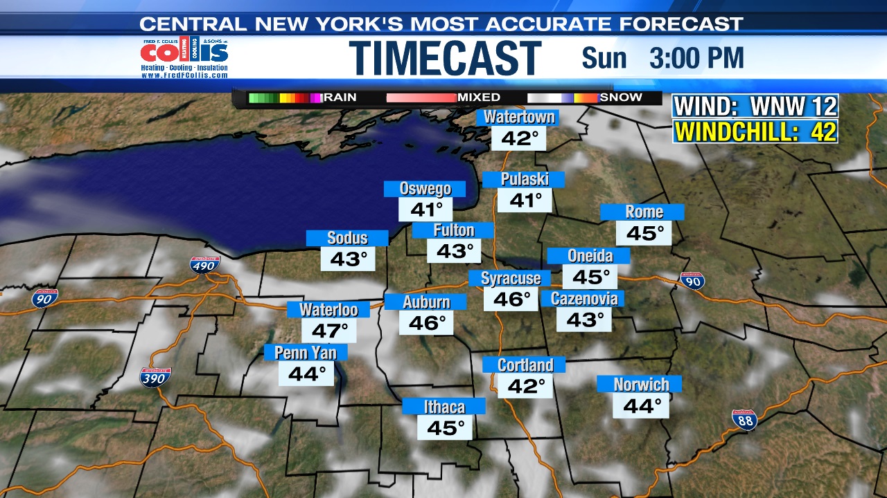
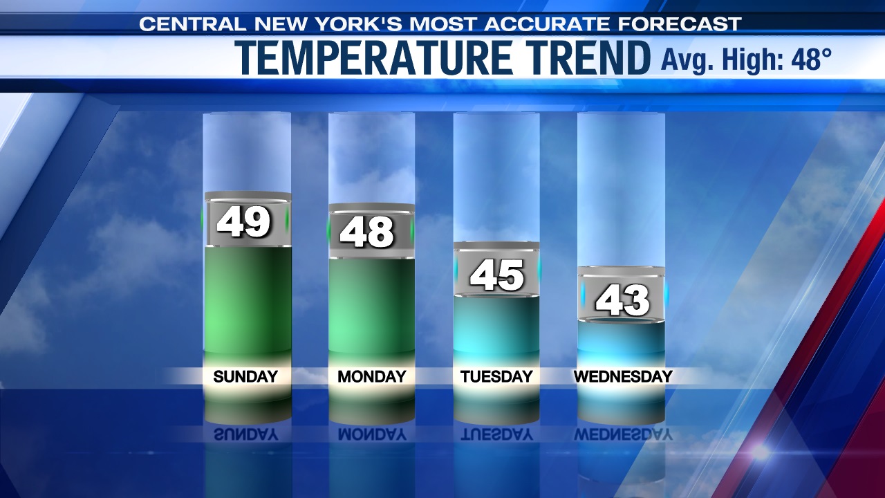
The best part of Easter will be the afternoon as sunshine returns towards midday, or lunch/brunch time and should hold throughout the rest of the day. With the sunshine returning later Sunday, temperatures are expected to rebound well into the 40s to near 50. Yes, if you can hold off on those egg hunts/outdoor activities with the kids until the afternoon.
Cool to chilly week ahead
The week starts out seasonably cool with highs in the mid to upper 40s, but temperatures drop to unseasonably chilly levels as more unsettled weather approaches mid to late week.
Close call Monday
A weak system passes just south of the state on Monday with the threat of a bit of light rain, especially near and south of Syracuse. There is a slight chance that we get through Monday dry with even a bit of sun, but this scenario as of Saturday night is looking less likely.
Turns wetter
After the weak system passes by the region to the south on Monday, we await a stronger system due to arrive Tuesday. This is the beginning of a gray, wet stretch of weather taking us through the midweek.
What? More snow?
With temperatures in the mid-40s on Tuesday, that’ll help keep most of the precipitation in the form of rain.
Another system develops Wednesday closer to the Mid-Atlantic coast as the storm system just north and west of CNY transfers its energy to the new storm. As this transferring of energy takes place, the air will start turning even colder, and probably cold enough for rain to change to snow over the higher terrain by days end Wednesday. The rest of CNY, including Syracuse probably sees the changeover to snow occur later Wednesday night.
Highs Wednesday likely struggle to reach the low 40s.
Snow may mix with rain at times Thursday before probably going back to snow Thursday night into Friday morning.
Snow accumulations of at least a few inches is possible for all of CNY with higher amounts potentially occurring over the hills between late Wednesday afternoon and lunch time Friday. Stay tuned for updates.


