Let the warm weather continue!
SYRACUSE, NY (WSYR-TV) –With winds much lighter, milder air continues to build back into central New York! How warm does it get? Details are below…
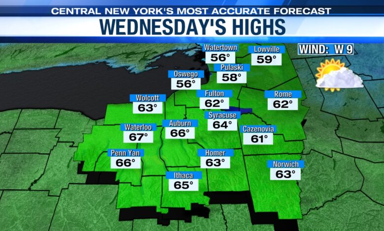
Turns even warmer
We’ll probably feel the 60s again come Wednesday despite more clouds!
A weak cold front moves through the region later in the afternoon but doesn’t have much moisture to work with. Outside a stray shower southeast of Syracuse in the afternoon, it is a dry day.
Have umbrella handy late in the week
We cool some to end the week as rain chances return but even that said we’ll remain warmer than average. There could be a shower or two as early as sunset Thursday but a better chance for widespread showers or even steady rain Thursday night possibly lingering into the start of Friday as low pressure tracks east across New York state.
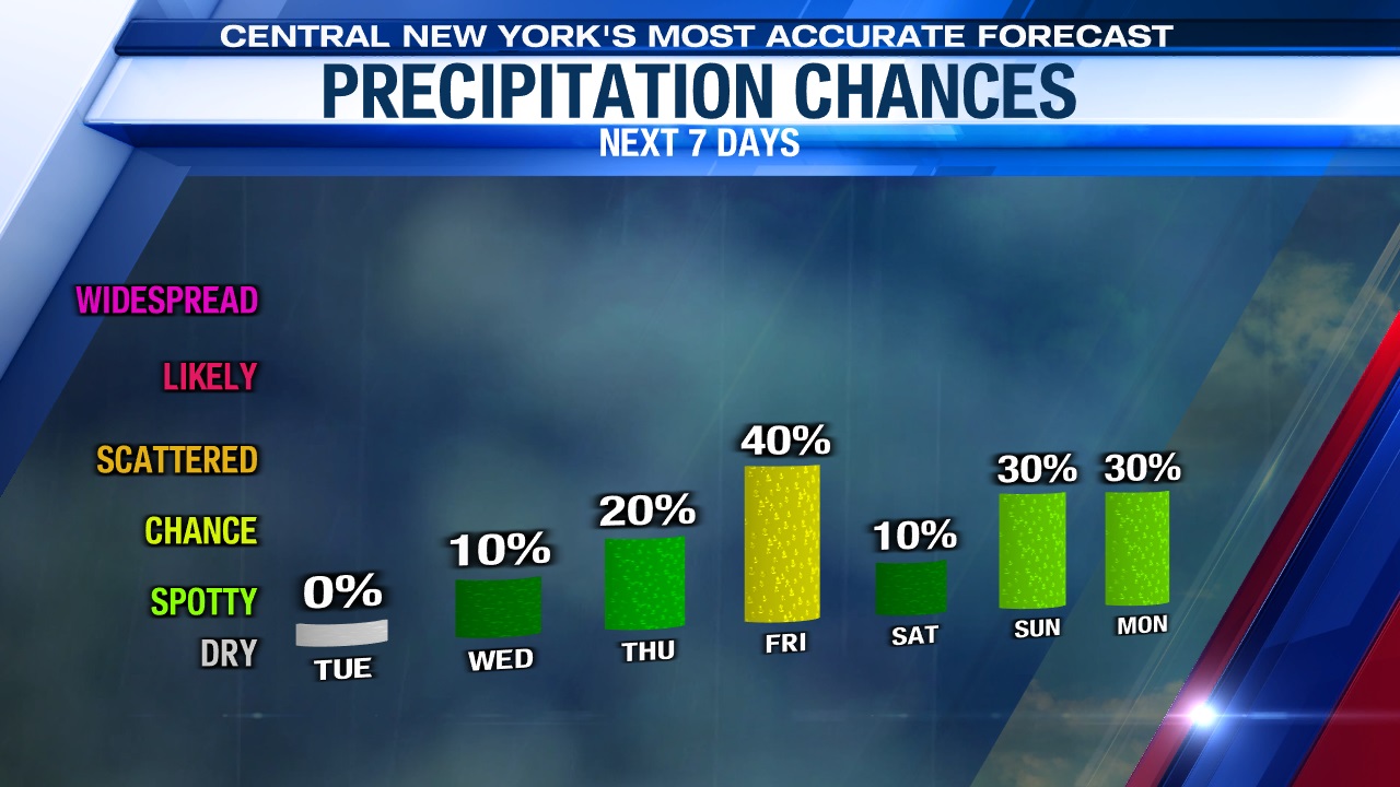
We think highs reach the 50s to around 60 on Thursday. Friday’s high will likely be a little cooler, closer to 50, in the wake of Thursday night’s system. Reminder, the average high this week in Syracuse is in the low 40s, so even low 50s is about 10 degrees above average.
Any ‘luck’ staying dry for the holiday weekend??
Yes, we think there will be some ‘luck’ for those out and about celebrating this holiday weekend.
We’ve got some good news for Saturday if you are headed to the St. Patrick’s Parade in downtown Syracuse. First, most of the showers from Friday and Friday night are moving out toward sunrise Saturday. While there could be a few lingering showers/patchy drizzle to start the day Saturday they would be light and should end before the start of the parade at Noon.
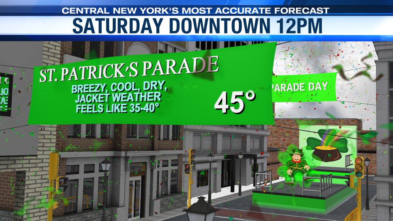
Second, temperatures look like they end up in the mid to upper 40s during the parade. If that’s ends up being the case that would make this year’s parade the warmest since 2016!
Unfortunately, it appears there’s a better chance of at least a few showers on St. Patrick’s Day itself with highs within a few degrees of 50 once again.
Stay tuned for updates.