Cold, frosty tonight; Milder & bright Monday

SYRACUSE, NY (WSYR-TV) – It’s very cold tonight, but spring air is on its way back. When, and how warm does it get?? Find out below…
Cold, frosty tonight, but feels more like spring Monday
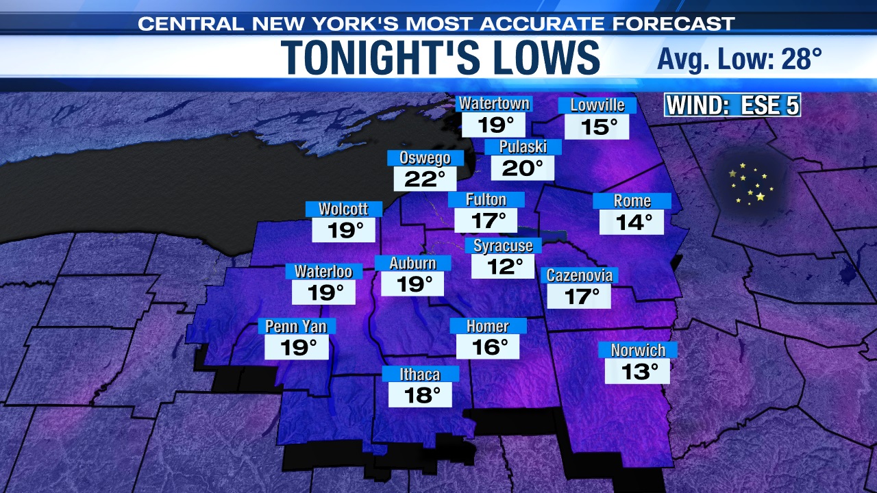
High pressure settled into the Northeast to round out the weekend and is staying put through the start of the new week. This sets the stage for a mainly clear, frosty cold night to view the penumbral lunar eclipse late tonight/early Monday if you are interested.
There also is a chance for us to catch a glimpse, away from city lights, of the Northern Lights late tonight thanks to a moderate geomagnetic storm.
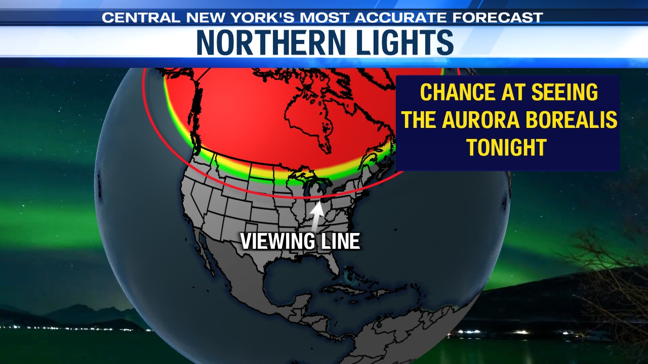
So, if you are heading out to try to view these astronomical spectacles be sure to bundle up as readings drop into the teens for most, and single digits for the normally colder spots of CNY north and east of Syracuse!
Milder temperatures return
Spring temperatures makes a comeback across the region over the next few days after a wintry past week to start spring officially.
Highs across the area are expected to be near 50 on Monday under lots of sun once again, and it’s even milder midweek.

These milder temperatures with sunshine should help melt much of the snow from the Friday night/Saturday system over the next few days.

Next chance of rain
The next chance of a few rain showers returns late Tuesday night into Wednesday as a cold front moves into the area, but much of Wednesday looks to be dry now.
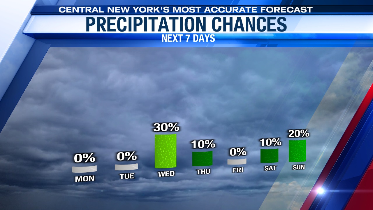
Drier conditions return for the end of the week in the wake of the front along with cooler, more seasonable temperatures as we head towards Easter weekend.
Stay tuned for updates.