Kicking March off mild and breezy
SYRACUSE, NY (WSYR-TV) – It’s a mild start to March and meteorological spring!
At a glance:
- Not as cold Tuesday, a bit of snow and rain expected
- Little to no snow accumulation for most, but several inches around the Tug Hill
- Turns colder again for the last half of the week
TUESDAY (Welcome to March and Meteorological Spring):
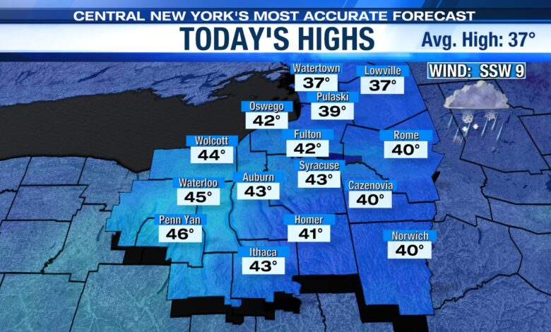
We thaw out Tuesday as highs warm into the low 40s. Unfortunately, a breeze between 10 and 20 mph with higher gusts out of the south will make it feel more like the 20s and low 30s much of the afternoon.
A fast-moving system, a clipper, dives in during the day and should produce at least some snow and rain showers, mainly during the second half of the day.
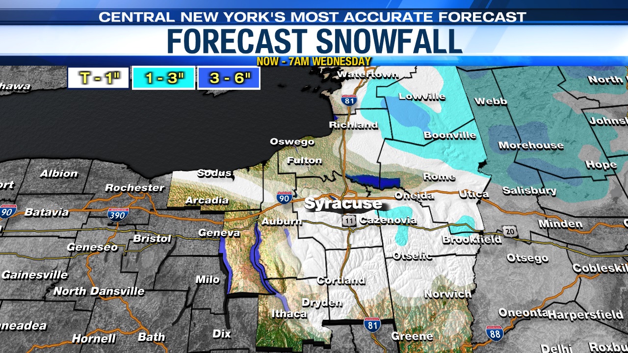
Most see little to no snow accumulation Tuesday, but there could be up to a slushy coating over the hills south of Syracuse. As much as 3 or 4 inches is possible in and around the Tug Hill where it’s a bit colder.
TUESDAY NIGHT:
Mainly snow showers move through CNY with possibly a slushy coating to an inch for all, but upwards of a couple inches is possible over the higher terrain.
WEDNESDAY:
There may be a touch of spotty flurry/freezing drizzle around to start Wednesday, otherwise much of Wednesday looks to be dry with a cooler, more seasonable high in the mid to upper 30s.
WEDNESDAY NIGHT – THURSDAY:
A developing storm system with a stronger cold front slides through the region Wednesday night. Some snow showers and squalls are likely Wednesday night.
It appears at least a good 1 to 3 inches of snow falls Wednesday night for most across CNY with locally higher amounts possible, especially across the higher terrain.
Temperatures drop into the teens to near 20 by daybreak Thursday with a gusty wind sending wind chills down into the single digits at times.
It looks like a chilly and quiet end to the week.