Who sees lake effect snow tonight?
SYRACUSE, NY (WSYR-TV) – Our latest winter storm is quickly departing, but in its wake, we have some lake snow. Will it stick around for the weekend?
As of 4 pm Friday Winter Storm Warnings and Advisories that were up for Central New York have been cancelled.
At a glance:
- Evening commute is much better for travel.
- Little lake snow Friday night.
- Snow squalls Sunday.
FRIDAY NIGHT:
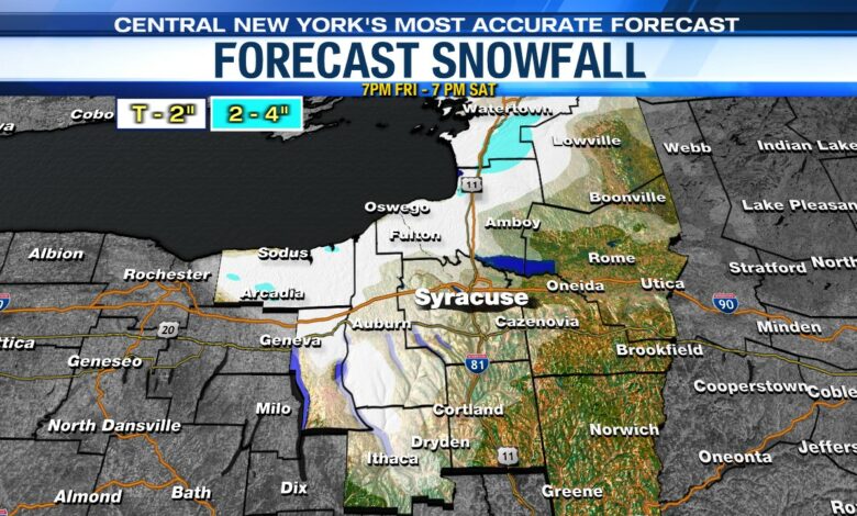
Northwesterly winds in the wake of the storm does open the door for a limited amount of lake effect snow showers Friday night into Saturday.
There could be an additional light accumulation of snow from Syracuse west into the Finger Lakes. Closer to the southern shoreline there may be 2-4” of additional snow by Saturday morning.
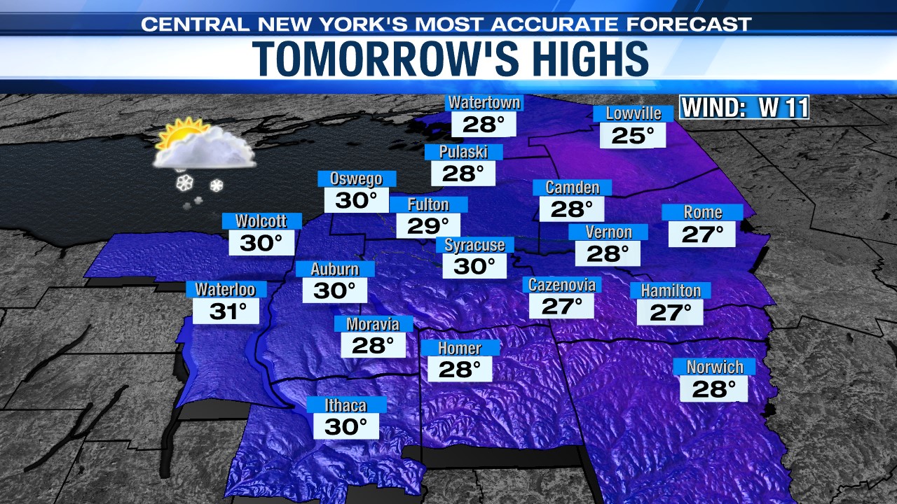
SATURDAY:
There may be some snow showers around Syracuse near sunrise, but that snow is quickly lifting north. Most of CNY is quiet with some breaks of sun.
East of the lake, snow showers linger into the afternoon.
Temperatures for everyone are seasonably cool and near 30.
SUNDAY:
Sunday starts out quiet for most, but there is a chance that some lake snow is still lingering northeast of Lake Ontario. That is, until a cold front drops from north to south.
This cold front is going to bring some snow to everyone. Not a lot for most, but it will bring the potential for snow squalls which will create reduced visibilities and quick changing road conditions. That is most likely between 11 am and 1 pm.
In the wake of the cold front, we expect winds to become quite gusty out of the northwest, at times exceeding 30 mph. That helps usher in some arctic air to start the weekend.