
Another round of storms this afternoon
SYRACUSE, NY (WSYR-TV) – Another round of spring thunderstorms is in store later today, some of which could be strong to even severe. Details are below…
When is the best chance for storms?
After seeing some sunshine through midday, the risk for additional showers and storms arrives again after 2 p.m. this afternoon.
The window for storms will not last for more than a few hours, however, with dry conditions returning across central New York by 7 or 8 p.m. this evening.
Is there a risk of severe weather?
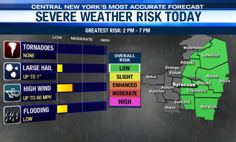
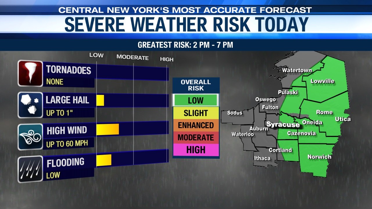
There is a chance that any storm that develops this afternoon into early this evening could be strong to severe.
Primary risks include heavy rain, frequent lightning, as well as the potential for damaging wind gusts around 60 mph and also some large hail.
Where is the severe storm risk greatest?
The area with the highest risk of severe storms will be near and north and east of Syracuse, extending approximately from the I-81 corridor eastward.
This risk area includes Syracuse, north toward the Tug Hill, south toward Cortland, and east into the Mohawk Valley.
With that being said, the risk of severe weather is low—a level 1 of 5 on the risk scale.
Be sure to download the Live Doppler 9 app and keep an eye on the radar this afternoon as storms develop.


